| Coolangatta New South Wales | |||||||||||||||
|---|---|---|---|---|---|---|---|---|---|---|---|---|---|---|---|
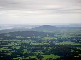
 A view of Coolangatta Mountain and Jervis Bay (in the background) from the Drawing Room Rocks area. The land around the mountain is in Shoalhaven LGA; this includes the small town of Berry (right front) | |||||||||||||||
 Coolangatta | |||||||||||||||
| Coordinates | 34°51′S 150°43′E / 34.850°S 150.717°E[1]) | ||||||||||||||
| Population | 329 (2016 census)[2] | ||||||||||||||
| Postcode(s) | 2535 | ||||||||||||||
| Elevation | 12 m (39 ft) | ||||||||||||||
| Location |
| ||||||||||||||
| LGA(s) | City of Shoalhaven | ||||||||||||||
| County | Camden | ||||||||||||||
| Parish | Coolangatta | ||||||||||||||
| State electorate(s) | Kiama | ||||||||||||||
| Federal division(s) | Gilmore | ||||||||||||||
| |||||||||||||||
Coolangatta is an historic area in Australia, on the north shore of the Shoalhaven River on the New South Wales south coast.
History

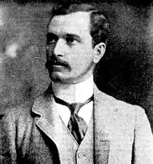
Alexander Hay, circ 1896, owner of Coolangatta Estate on the Shoalhaven River from 1909 to 1941
Cullunghutti is a Jerrinja word meaning "splendid view".[3][4] Behind the settlement is a tall hill known as Coolangatta Mountain. In 1822 Scotsman Alexander Berry settled and built an estate (Coolangatta Estate) in the area, he was the first European to settle in the Shoalhaven area. In 1846 the brigantine ship Coolangatta, named by Berry for his estate, was wrecked on what is today Queensland's Gold Coast. It's from that ship that the better known Coolangatta, Queensland gets its name.[5]
References
- ↑ "Coolangatta". Gazetteer of Australia online. Geoscience Australia, Australian Government.
- ↑ Australian Bureau of Statistics (27 June 2017). "Coolangatta". 2016 Census QuickStats. Retrieved 23 July 2017.
- ↑ Shoalhaven Heads & Coolangatta page at www.southcoast.com.au
- ↑ "Coolangatta". Geographical Names Register (GNR) of NSW. Geographical Names Board of New South Wales. Retrieved 12 July 2009.
- ↑ On This Day (pdf) Archived June 17, 2011, at the Wayback Machine at the Shoalhaven City Council
External links
This article is issued from Wikipedia. The text is licensed under Creative Commons - Attribution - Sharealike. Additional terms may apply for the media files.