| Cottonwood Creek | |
|---|---|
 Cottonwood Creek | |
 Location of mouth | |
| Location | |
| Country | United States |
| State | Oklahoma |
| Physical characteristics | |
| Mouth | |
• coordinates | 35°54′15″N 97°26′42″W / 35.90411°N 97.44492°W |
| Length | approx. 30 miles |
| Discharge | |
| • average | 10322 [1] |
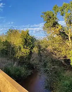
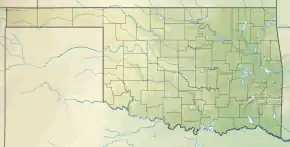
Cottonwood Creek is a stream that flows from rural Canadian County through portions of Logan County until it reaches its mouth at the Cimarron River, northwest of Guthrie.
Significant tributaries of Cottonwood Creek include Chisholm Creek and Deer Creek. Its source is located in rural Canadian County northwest of the city of Piedmont. The stream drains approximately 320 square miles.[2]
The creek has often caused flooding in Guthrie.[3][4][5] It is also the namesake of the Cottonwood Flats Festival Ground in Guthrie.[6]
Historic flood levels
| Crest level in feet | Date |
|---|---|
| 30.00 | 10/20/1983 |
| 29.60 | 05/09/1993 |
| 29.26 | 10/02/1959 |
| 28.58 | 05/15/1949 |
| 28.09 | 09/21/1965 |
| 27.90 | 05/28/1987 |
| 27.90 | 06/09/1995 |
| 27.40 | 05/22/2019 |
| 27.40 | 06/01/2013 |
| 27.20 | 09/13/1989 |
References
- ↑ "USGS 07159750 Cottonwood Creek near Seward, OK" Waterdata.usgs.gov Accessed Oct. 26, 2021.
- ↑ "USGS 07159750 Cottonwood Creek near Seward, OK" Waterdata.usgs.gov Accessed Oct. 26, 2021.
- ↑ "Floods in Guthrie, Oklahoma" US Army Corps of Engineers (1970) (Archived at LOC.gov, accessed Oct. 26, 2021)
- ↑ "Guthrie flooding keeps schools, roads closed" News9.com (May 22, 2019)
- ↑ "Recent flood ranks in top 10" GuthriesNewsPage.com (May 22, 2019)
- ↑ McDonnell, Brandy "Oklahoma International Bluegrass Fest continues after death of founder Byron Berline" The Oklahoman (Sept. 28, 2021) Accessed Oct. 26, 2021.
- ↑ "Recent flood ranks in top 10" GuthriesNewsPage.com (May 22, 2019)
This article is issued from Wikipedia. The text is licensed under Creative Commons - Attribution - Sharealike. Additional terms may apply for the media files.