Cowley | |
|---|---|
| Village of Cowley | |
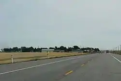
 Looking east at Cowley on AB3 (Crowsnest Highway) | |
 Cowley Location of Cowley in Alberta | |
| Coordinates: 49°34′03.7″N 114°04′08.7″W / 49.567694°N 114.069083°W | |
| Country | Canada |
| Province | Alberta |
| Region | Southern Alberta |
| Census division | 3 |
| Municipal district | Municipal District of Pincher Creek No. 9 |
| Incorporated[1] | |
| • Village | August 16, 1906 |
| Government | |
| • Mayor | Garry Hackler (Deputy) |
| • Governing body | Cowley Village Council |
| Area (2021)[3] | |
| • Land | 1.36 km2 (0.53 sq mi) |
| Elevation | 1,175 m (3,855 ft) |
| Population (2021)[3] | |
| • Total | 216 |
| • Density | 159.2/km2 (412/sq mi) |
| Time zone | UTC−7 (MST) |
| • Summer (DST) | UTC−6 (MDT) |
| Area code(s) | +1-403, +1-587 |
| Highways | Highway 3 Highway 510 |
| Waterway | Oldman River Reservoir |
| Website | cowley |
Cowley is a village in southern Alberta, Canada. It is west of Lethbridge and surrounded by the Municipal District of Pincher Creek No. 9.
It was settled in the 1880s and named by a rancher. Cowley Post Office opened in 1900, and in 1906 Cowley was incorporated as village. The community's name is a combination of "cow" and "lea".[5]
Demographics
In the 2021 Census of Population conducted by Statistics Canada, the Village of Cowley had a population of 216 living in 96 of its 110 total private dwellings, a change of 3.3% from its 2016 population of 209. With a land area of 1.36 km2 (0.53 sq mi), it had a population density of 158.8/km2 (411.4/sq mi) in 2021.[3]
In the 2016 Census of Population conducted by Statistics Canada, the Village of Cowley recorded a population of 209 living in 100 of its 113 total private dwellings, a change of -11.4% from its 2011 population of 236. With a land area of 1.37 km2 (0.53 sq mi), it had a population density of 152.6/km2 (395.1/sq mi) in 2016.[6]
Arts and culture
Cowley was featured in the 2005 motion picture Brokeback Mountain as the fictional town of Signal, Wyoming.
Cowley is featured on a 17c postage stamp issued by Canada Post in 1980 (August 27) to mark the 75th anniversary of the creation of the Province of Alberta.
See also
References
- ↑ "Location and History Profile: Village of Cowley" (PDF). Alberta Municipal Affairs. October 14, 2016. p. 197. Retrieved October 17, 2016.
- ↑ "Municipal Officials Search". Alberta Municipal Affairs. May 9, 2019. Retrieved October 1, 2021.
- 1 2 3 "Population and dwelling counts: Canada, provinces and territories, and census subdivisions (municipalities)". Statistics Canada. February 9, 2022. Retrieved February 9, 2022.
- ↑ "Alberta Private Sewage Systems 2009 Standard of Practice Handbook: Appendix A.3 Alberta Design Data (A.3.A. Alberta Climate Design Data by Town)" (PDF) (PDF). Safety Codes Council. January 2012. pp. 212–215 (PDF pages 226–229). Archived from the original (PDF) on October 16, 2013. Retrieved October 8, 2013.
- ↑ Place-names of Alberta. Ottawa: Geographic Board of Canada. 1928. p. 38.
- ↑ "Population and dwelling counts, for Canada, provinces and territories, and census subdivisions (municipalities), 2016 and 2011 censuses – 100% data (Alberta)". Statistics Canada. February 8, 2017. Retrieved February 8, 2017.