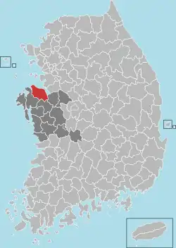
Dangjin
당진 | |
|---|---|
| Korean transcription(s) | |
| • Hangul | 당진 |
| • Hanja | 唐津 |
| • Revised Romanization | Dangjin |
| • McCune-Reischauer | Tangjin |
 Flag  Emblem of Dangjin | |
 Location in South Korea | |
| Country | |
| Region | Hoseo |
| Administrative divisions | 2 eup, 9 myeon, 3 dong |
| Area | |
| • Total | 664.13 km2 (256.42 sq mi) |
| Population (2002) | |
| • Total | 117,409 |
| • Density | 176.8/km2 (458/sq mi) |
| • Dialect | Chungcheong |
Dangjin (Korean: 당진; Korean pronunciation: [taŋ.dʑin]) is a city in South Chungcheong Province, South Korea. It stands on the south shore of the Bay of Asan. Dangjin borders Incheon, Pyeongtaek, and Hwaseong by sea, and Seosan, Yesan, and Asan by land. Its name means "Tang ferry," and refers to the historic role of Dangjin's harbor in connecting Korea to the other side of the Yellow Sea. This role continues to be important in the city's economy, which relies on a mixture of agriculture and heavy industry. The city has the same Hanja name (唐津市) as Karatsu in Saga Prefecture, Japan.
Administrative divisions
The city is divided into 2 eup, 9 myeon and 3 dong.
History
The name "Dangjin" was first used to refer to this area during the Joseon Dynasty. From 1413 to 1895, it was known as Dangjin-hyeon, a division of Chungcheong Province. The city achieved its present borders in 1973, with the merger of a portion of Jeongmi-myeon into Seosan's Unsan-myeon. It was originally a county but was promoted to a city on January 1, 2012, after a rapid population boost.
Being on the Yellow Sea, the port has been important for trade with China, and since early times was defended against foreign invasion by becoming a fortress city (Eupseong). According to legend, the eupseong was built in the 16th year of King Chungyeol (1290 AD), but it is currently believed to have been built during the Baekje period and modified throughout the Joseon period to prevent foreign invasion. Mianchuan Eupseong is a city with four gates in the east, west, south, and north. It was rebuilt in the 13th year of King Taejong of the Joseon Dynasty, and it was rebuilt during the reign of King Gyeongjong.[1]
Climate
Dangjin has a humid continental climate (Köppen: Dwa), but can be considered a borderline humid subtropical climate (Köppen: Cwa) using the −3 °C (27 °F) isotherm.
| Climate data for Dangjin (1993–2020 normals) | |||||||||||||
|---|---|---|---|---|---|---|---|---|---|---|---|---|---|
| Month | Jan | Feb | Mar | Apr | May | Jun | Jul | Aug | Sep | Oct | Nov | Dec | Year |
| Mean daily maximum °C (°F) | 2.6 (36.7) |
5.2 (41.4) |
10.9 (51.6) |
17.5 (63.5) |
23.0 (73.4) |
26.8 (80.2) |
28.9 (84.0) |
30.0 (86.0) |
25.9 (78.6) |
20.1 (68.2) |
12.4 (54.3) |
4.9 (40.8) |
17.4 (63.3) |
| Daily mean °C (°F) | −2.0 (28.4) |
0.0 (32.0) |
4.9 (40.8) |
11.0 (51.8) |
16.8 (62.2) |
21.1 (70.0) |
24.6 (76.3) |
25.3 (77.5) |
20.5 (68.9) |
14.0 (57.2) |
7.0 (44.6) |
0.3 (32.5) |
12.0 (53.6) |
| Mean daily minimum °C (°F) | −6.4 (20.5) |
−4.6 (23.7) |
−0.2 (31.6) |
5.5 (41.9) |
11.5 (52.7) |
16.8 (62.2) |
21.4 (70.5) |
21.9 (71.4) |
16.2 (61.2) |
8.7 (47.7) |
2.1 (35.8) |
−4.2 (24.4) |
7.4 (45.3) |
| Average precipitation mm (inches) | 17.2 (0.68) |
26.9 (1.06) |
34.6 (1.36) |
67.8 (2.67) |
85.3 (3.36) |
115.3 (4.54) |
294.4 (11.59) |
265.9 (10.47) |
136.0 (5.35) |
53.1 (2.09) |
45.7 (1.80) |
23.3 (0.92) |
1,165.5 (45.89) |
| Average precipitation days (≥ 0.1 mm) | 4.5 | 3.7 | 5.3 | 6.2 | 6.7 | 7.0 | 13.0 | 11.8 | 7.5 | 5.3 | 8.1 | 6.7 | 85.8 |
| Source: Korea Meteorological Administration[2] | |||||||||||||
Education
As of March 2005, in Dangjin there were 33 elementary schools, 12 middle schools, and 38 preschools, serving 14,293 students.[3] In addition, there were 8 high schools. All of these organs are overseen by the Dangjin Office of Education.
The sole institution of higher education in the city is Shinsung College.
Economy
Dangjin is home to a number of factories, including steel mills operated by Hyundai Hysco and Hyundai INI Steel. These factories are supplied in part by ships docking at Dangjin Harbor, a cargo port with 5 piers, two of which are dedicated to steel coil shipping.[4]
Sister cities
 Bergen County, New Jersey, United States
 Snohomish County, Washington, United States
 – Daisen, Akita, Japan[5]
Dangjin also has sister city relationships with parts of Liaoning and Jilin provinces, China.
Domestic
- Gangbuk-gu, Seoul
- Nam-gu (Incheon)
- Yongsan-gu, Seoul
References
- ↑ "唐津沔川邑城(당진면천읍성) - 景點 - 韓國旅行和旅遊信息". www.koreatriptips.com (in Chinese (Taiwan)). Retrieved 2023-08-10.
- ↑ "Climatological Normals of Korea (1991 ~ 2020)" (PDF) (in Korean). Korea Meteorological Administration. Archived from the original (PDF) on 29 January 2022. Retrieved 7 June 2023.
- ↑ 일반현황. www.cndje.go.kr.
- ↑ "Archived copy". Archived from the original on 2014-02-03. Retrieved 2006-01-09.
{{cite web}}: CS1 maint: archived copy as title (link) - ↑ "International Exchange". List of Affiliation Partners within Prefectures. Council of Local Authorities for International Relations (CLAIR). Archived from the original on 21 November 2015. Retrieved 21 November 2015.
