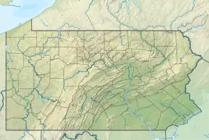
| Dark Hollow Run | |
|---|---|
 Dark Hollow Run | |
| Location | |
| Country | United States |
| State | Pennsylvania |
| County | Bucks |
| Township | Solebury |
| Physical characteristics | |
| Source | |
| • coordinates | 40°20′29″N 74°58′4″W / 40.34139°N 74.96778°W |
| • elevation | 300 feet (91 m) |
| Mouth | |
• coordinates | 40°21′27″N 74°56′57″W / 40.35750°N 74.94917°W |
• elevation | 62 feet (19 m) |
| Length | 1.54 miles (2.48 km) |
| Basin size | 71 square miles (180 km2) |
| Basin features | |
| Progression | Dark Hollow Run → Delaware River → Delaware Bay |
| River system | Delaware River |
| Bridges | Aquetong Road South Sugan Road Pennsylvania Route 32 (River Road) |
| Slope | 154.55 feet per mile (29.271 m/km) |
Dark Hollow Run is a tributary of the Delaware River contained wholly within Solebury Township, Bucks County, Pennsylvania, meeting with the Delaware south of New Hope.
History
A branch line of the Postal Telegraph Company was connected with the main line from Trenton, NJ, in the summer of 1888.[1]
Statistics
The Geographic Name Information System I.D. is 1172941, [2] U.S. Department of the Interior Geological Survey I.D. is 03034. [3]
Course
Dark Hollow Run rises south of Aquetong Road at an elevation of 300 feet (91 m) and runs for about a mile and a half to its confluence with the Delaware River at the river's 148.20 River Mile at an elevation of 62 feet (19 m), resulting in an average slope of 154.55 feet per mile (29.271 m/km).[2]
Municipalities
Crossings and Bridges
- Pennsylvania Route 32 (River Road)-NBI structure number 6792, bridge is 8 metres (26 ft) long concrete Tee Beam constructed 1959.[4]
- South Sugan Road
- Aquetong Road
References
- ↑ MacReynolds, George, Place Names in Bucks County, Pennsylvania, Doylestown, Bucks County Historical Society, Doylestown, PA, 1942, P96.
- 1 2 "GNIS Feature Search". geonames.usgs.gov. U.S. Geological Survey, U.S. Department of the Interior. Retrieved 16 September 2017.
- ↑ http://www.lycoming.edu/cwi/pdfs/paGazetterOfStreams.pdf, page 51
- ↑ "The National Bridge Inventory Database". nationalbridges.com. U.S. Geological Survey, U.S. Department of the Interior. Archived from the original on 31 October 2013. Retrieved 16 September 2017.
This article is issued from Wikipedia. The text is licensed under Creative Commons - Attribution - Sharealike. Additional terms may apply for the media files.