Daulatpur Chowk | |
|---|---|
town | |
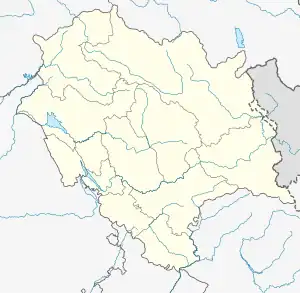
 Daulatpur Chowk Location in Himachal Pradesh, India  Daulatpur Chowk Daulatpur Chowk (India) | |
| Coordinates: 31°48′N 75°59′E / 31.8°N 75.98°E | |
| Country | |
| State | Himachal Pradesh |
| District | Una |
| Government | |
| • Body | Government of Himachal Pradesh |
| Elevation | 521 m (1,709 ft) |
| Population (2011) | |
| • Total | 3,765 |
| Languages | |
| • Official | Hindi |
| • Local | Dogri and Punjabi |
| Time zone | UTC+5:30 (IST) |
| Vehicle registration | HP-19AA- |
Daulatpur Chowk is a Nagar Panchayat in Tehsil Ghanari of Una district in the State of Himachal Pradesh, India. Daulatpur Chowk is also connected through Railway line which comes from Una Himachal . Railway station of Daulatpur chowk is situated in the nearby village Chalet which is approximately 2 km from Bus Stand.
Geography
Daulatpur is located at 31°48′N 75°59′E / 31.8°N 75.98°E.[1] It has an average elevation of 521 metres (1709 feet).
Demographics
As of 2011 India census,[2] Daulatpur had a population of 3765. Males constitute 50% of the population and females 50%. Daulatpur has an average literacy rate of 79%, higher than the national average of 74.04%: male literacy is 82% and, female literacy is 76%. In Daulatpur, 11% of the population is under 6 years of age.
1. The main crop in Daulatpur is wheat, which is common in Punjab region
2. The very famous temple of Hindu Goddess Mata Chintapurni is nearby (approximately 18 k.m.)
3. Kua Devi temple is also a pride of the region which is approx 3km far.
4. Famous Gurudwara and Shiv temple is located in nearby village Babehar. Annual function on Holiday and Baisakhi is celebrated here.
5. Kuneran Railway station's new name is Mata Chintapurni Station
6. Main market of Daulatpur is nearby Daulatpur Chowk
References
- ↑ Falling Rain Genomics, Inc - Daulatpur
- ↑ "Census of India 2001: Data from the 2001 Census, including cities, villages and towns (Provisional)". Census Commission of India. Archived from the original on 16 June 2004. Retrieved 1 November 2008.