Delnice | |
|---|---|
| Grad Delnice Town of Delnice | |
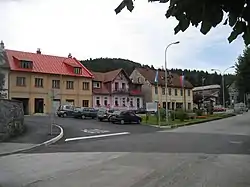
 Delnice town center | |
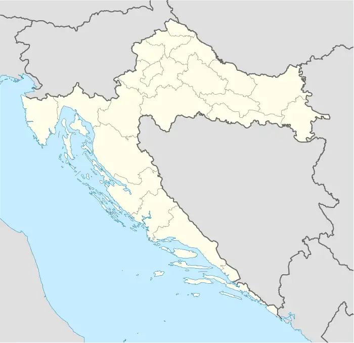
 Delnice Location of Delnice in Croatia | |
| Coordinates: 45°24′04″N 14°48′00″E / 45.401°N 14.800°E | |
| Country | |
| County | Primorje-Gorski Kotar |
| Government | |
| • Mayor | Katarina Mihelčić (Ind.) |
| Area | |
| • Town | 230.9 km2 (89.2 sq mi) |
| • Urban | 24.4 km2 (9.4 sq mi) |
| Population (2021)[2] | |
| • Town | 5,135 |
| • Density | 22/km2 (58/sq mi) |
| • Urban | 3,861 |
| • Urban density | 160/km2 (410/sq mi) |
| Time zone | UTC+1 (Central European Time) |
| Vehicle registration | DE |
| Website | delnice |
Delnice (Croatian pronunciation: [děːlnit͡se̞]) is a town in western Croatia, the largest settlement in the mountainous region of Gorski Kotar, in the Primorje-Gorski Kotar County. The town has a population of 4,379, and total municipality population is 5,952 (2011). Delnice is Gorski Kotar's main town.
Demographics
The municipality consists of the following settlements:[3]
- Bela Vodica, population 24
- Belo, population 9
- Biljevina, population 4
- Brod na Kupi, population 207
- Crni Lug, population 253
- Čedanj, population 9
- Dedin, population 93
- Delnice, population 4,379
- Donja Krašićevica, no population
- Donje Tihovo, population 5
- Donji Ložac, population 6
- Donji Okrug, population 2
- Donji Turni, no population
- Gašparci, population 15
- Golik, population 16
- Gornja Krašićevica, population 2
- Gornje Tihovo, population 6
- Gornji Ložac, population 10
- Gornji Okrug, population 2
- Gornji Turni, population 13
- Grbajel, population 17
- Guče Selo, population 27
- Gusti Laz, population 4
- Hrvatsko, population 49
- Iševnica, population 9
- Kalić, population 4
- Kočičin, population 1
- Krivac, population 23
- Kupa, population 8
- Kuželj, population 52
- Leska, population 3
- Lučice, population 332
- Mala Lešnica, population 8
- Malo Selo, population 62
- Marija Trošt, population 46
- Plajzi, no population
- Podgora Turkovska, population 8
- Požar, population 8
- Radočaj Brodski, population 40
- Raskrižje Tihovo, population 7
- Razloge, population 8
- Razloški Okrug, population 5
- Sedalce, population 16
- Srednja Krašićevica, no population
- Suhor, no population
- Ševalj, no population
- Turke, population 31
- Velika Lešnica, population 16
- Velika Voda, no population
- Zagolik, no population
- Zakrajc Turkovski, population 2
- Zalesina, population 41
- Zamost Brodski, population 36
- Zapolje Brodsko, population 34
- Zelin Crnoluški, no population
| population | 6929 | 7289 | 6797 | 7007 | 7172 | 7651 | 7322 | 7337 | 6609 | 7592 | 7652 | 7291 | 6817 | 6858 | 6262 | 5952 | 5135 |
| 1857 | 1869 | 1880 | 1890 | 1900 | 1910 | 1921 | 1931 | 1948 | 1953 | 1961 | 1971 | 1981 | 1991 | 2001 | 2011 | 2021 |
History
The town was first mentioned in a 1482 document issued by Sabor, the Croatian Parliament.
In the late 19th and early 20th centuries, Delnice was a district capital in the Modruš-Rijeka County of the Kingdom of Croatia-Slavonia.
Transportation
Delnice is well connected to numerous local and national destinations by train and bus. Rijeka (Croatia's third largest city) is half an hour away by road.
Tourism
Delnice, along with the surrounding county of Gorski Kotar's pristine nature offer a plethora of outdoor opportunities for an active vacation. Some of the activities include Cycling, Mountain Climbing, Rock Climbing, Running, Hiking, Cross Country running, Skiing, Cross Country Skiing, Snowboarding, Camping, Kayaking, River Rafting and Hunting. Delnice has many shops, bars and restaurants.
References
- ↑ Register of spatial units of the State Geodetic Administration of the Republic of Croatia. Wikidata Q119585703.
- ↑ "Population by Age and Sex, by Settlements, 2021 Census". Census of Population, Households and Dwellings in 2021. Zagreb: Croatian Bureau of Statistics. 2022.
- ↑ "Population by Age and Sex, by Settlements, 2011 Census: Delnice". Census of Population, Households and Dwellings 2011. Zagreb: Croatian Bureau of Statistics. December 2012.
External links
45°24′N 14°48′E / 45.400°N 14.800°E
