Despatch
Despatchers | |
|---|---|
 Despatch  Despatch | |
| Coordinates: 33°48′5.57″S 25°28′36.41″E / 33.8015472°S 25.4767806°E | |
| Country | South Africa |
| Province | Eastern Cape |
| Municipality | Nelson Mandela Bay |
| Area | |
| • Total | 19.65 km2 (7.59 sq mi) |
| Population (2011)[1] | |
| • Total | 39,619 |
| • Density | 2,000/km2 (5,200/sq mi) |
| Racial makeup (2011) | |
| • Black African | 36.9% |
| • Coloured | 17.8% |
| • Indian/Asian | 0.2% |
| • White | 44.7% |
| • Other | 0.4% |
| First languages (2011) | |
| • Afrikaans | 59.7% |
| • Xhosa | 33.2% |
| • English | 5.1% |
| • Other | 2.0% |
| Time zone | UTC+2 (SAST) |
| Postal code (street) | 6220 |
| PO box | 6219 |
| Area code | 041 |
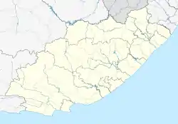
Despatch is a small town in the Eastern Cape Province of South Africa situated between Port Elizabeth and Uitenhage with an estimated population of 40 000. It forms part of the Nelson Mandela Bay Metropolitan Municipality which includes Port Elizabeth and Uitenhage, and has collectively a population of over 1.3 million.
History
The town of Despatch is situated on rich clay soil and in the late 1800s was the site of a flourishing brick industry. Despatch's name derives from this brick industry history on the account that bricks were dispatched from the original railway siding. Many of the older buildings in Uitenhage and Port Elizabeth were built from these bricks. Most of these early bricks can be identified by the word 'Despatch' imprinted on the top and bottom of the brick. The only reminder of the town's brick industry past is a chimney built in 1882 which formed part of the Brick Works. The Chimney is situated in a field on the outskirts of the town to the north next to the railway lines. In recent years restoration work has brought it back to its former glory including supports which now give it the appearance of a space rocket.
In 1903 the remains of an Algoasaurus were discovered near Despatch.
The township of Despatch was originally developed in 1942 to offer cheaper homing alternative for its fast growing neighbours of Uitenhage and Port Elizabeth. The town obtained official municipal status in 1945 and in 2001 it jointed with Uitenhage, Port Elizabeth and surrounding areas to form the Nelson Mandela Bay Metropolitan Municipality.
Transport
Roads
The R75 highway bypasses Despatch to the south and west leading northwards to Graaff-Reinet and southwards to iBhayi and Port Elizabeth with two interchanges at the M6 and an interchange at the M19.
The M6 route bypasses Despatch to the east and north leading eastwards from the R75/M19 interchange to Uitenhage. The M10 route skirts Despatch to the west leading northwards to Uitenhage Industrues and southwards to Bethelsdorp. The M19 route intersects Despatch as its main thoroughfare leading eastwards from the M10 to Swartkops as Botha Street and Main Street. Main Street serves as the main street through the central business district of Despatch.
Notable residents
- Johan Botha - cricketer
- Rassie Erasmus - rugby coach
- Adri Geldenhuys—rugby player
- Danie Gerber - rugby player
- Rynard Landman - rugby player
- Rudi Koertzen - cricket umpire
- Charl Mattheus - Comrades Marathon runner
- Elric van Vuuren - rugby player
- Evan van der Merwe - cricket umpire
- Sam Gerber - rugby player
- Daniel du Plessis - rugby player
- Arnold Vosloo - Hollywood Actor
- Elandrè Schwartz - Singer
References
- 1 2 3 4 "Main Place Despatch". Census 2011.
.svg.png.webp)