Dobev | |
|---|---|
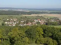
 Velké Nepodřice, a part of Dobev | |
 Flag  Coat of arms | |
 Dobev Location in the Czech Republic | |
| Coordinates: 49°17′45″N 14°2′50″E / 49.29583°N 14.04722°E | |
| Country | |
| Region | South Bohemian |
| District | Písek |
| First mentioned | 1318 |
| Area | |
| • Total | 21.22 km2 (8.19 sq mi) |
| Elevation | 385 m (1,263 ft) |
| Population (2023-01-01)[1] | |
| • Total | 1,058 |
| • Density | 50/km2 (130/sq mi) |
| Time zone | UTC+1 (CET) |
| • Summer (DST) | UTC+2 (CEST) |
| Postal code | 397 01 |
| Website | www |
Dobev is a municipality in Písek District in the South Bohemian Region of the Czech Republic. It has about 1,100 inhabitants.
Administrative parts
_(37).jpg.webp)
The municipality is made up of villages of Malé Nepodřice, Nová Dobev, Oldřichov, Stará Dobev and Velké Nepodřice. The municipal office is located in Stará Dobev, which is the largest and most populated part.
Geography
Orlík nad Vltavou is located about 7 kilometres (4 mi) west of Písek and 46 km (29 mi) northwest of České Budějovice. The western part of the municipal territory lies in the České Budějovice Basin, the eastern part lies in the Tábor Uplands. The highest point is the hill Velký Kamýk with an altitude of 531 metres (1,742 ft). The municipality contains several ponds, the largest being Dobevský.
History
The first written mention of Dobev is from 1318.[2]
Transport
Dobev is situated on the road from Písek to Strakonice. The D4 motorway passes through the northwestern part of the municipal territory.
Sights
The landmark of Dobev is the Church of Saint Brice from the late 14th century. The originally Gothic church was rebuilt in 1881.[3]
Notable people
- Václav Holek (1886–1954), firearm engineer
References
- ↑ "Population of Municipalities – 1 January 2023". Czech Statistical Office. 2023-05-23.
- ↑ "O celé obci" (in Czech). Obec Dobev. Retrieved 2022-08-31.
- ↑ "Kostel sv. Brikcí" (in Czech). National Heritage Institute. Retrieved 2022-08-31.