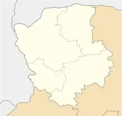
Domanove
Доманове | |
|---|---|
 Domanove  Domanove | |
| Coordinates: 51°49′26″N 24°20′30″E / 51.82389°N 24.34167°E | |
| Country | |
| Oblast | |
| Raion | Kovel Raion |
| Hromada | Ratne Hromada |
| Rural council | Mlynove Rural Council |
| Government | |
| • Mayor | Anatoliy Onishchuk (Ukrainian People's Party) |
| Area | |
| • Total | 734 km2 (283 sq mi) |
| Elevation | 151 m (495 ft) |
| Population (2001) | 289 |
| • Density | 393.73/km2 (1,019.8/sq mi) |
| Postal code | 44188 |
| Area code | +380 3366 |
Domanove (Ukrainian: Доманове, Polish: Domanowo) is a village in Kovel Raion, Rivne Oblast, Ukraine.
Geography
Situated in the northwest corner of Ukraine, Domanove is located on Ukraine's border with Belarus. The Domanove border checkpoint is just north of the village; the Belarusian town of Mokrany is directly across the border. It lies on European route E85, which connects it to the regional capital of Lutsk, 148 kilometers to the southwest.[1] Domanove is 23 kilometers from Ratne, the nearest sizable town.
In the interwar period, the village was a part of the Volhynian Voivodeship of the Second Polish Republic.
Climate
The village experiences a humid continental climate.
Demographics
The 1989 census of the Ukrainian Soviet Socialist Republic reported a population of 293 in the village. By the Ukrainian census of 2001, the population fell to 289.[2]
Language
According to the 2001 census, 98.96% of residents spoke Ukrainian as their first language, 0.69% spoke Russian, and 0.35% spoke Belarusian.[2]
Gallery
_06.jpg.webp) The Domanove border checkpoint
The Domanove border checkpoint_05.jpg.webp) A truck stopped at the border crossing
A truck stopped at the border crossing_03.jpg.webp) Ukrainian border control at the Domanove checkpoint
Ukrainian border control at the Domanove checkpoint_10.jpg.webp) Duty free store in Domanove, on the Ukrainian side of the border with Belarus
Duty free store in Domanove, on the Ukrainian side of the border with Belarus
See also
References
- ↑ International E Road Network (PDF) (Map). United Nations Economic Commission for Europe. Retrieved 25 June 2021.
- 1 2 "Перепис населення". ukrcensus.gov.ua (in Ukrainian). State Statistics Service of Ukraine. 2001. Retrieved 7 June 2021.