Erie–Ottawa International Airport Authority Carl R. Keller Field | |||||||||||||||
|---|---|---|---|---|---|---|---|---|---|---|---|---|---|---|---|
| Summary | |||||||||||||||
| Airport type | Public | ||||||||||||||
| Owner | Erie–Ottawa Airport Authority | ||||||||||||||
| Serves | Port Clinton, Ohio | ||||||||||||||
| Elevation AMSL | 590 ft / 180 m | ||||||||||||||
| Coordinates | 41°30′59″N 082°52′10″W / 41.51639°N 82.86944°W | ||||||||||||||
| Website | PortClintonAirport.com | ||||||||||||||
| Map | |||||||||||||||
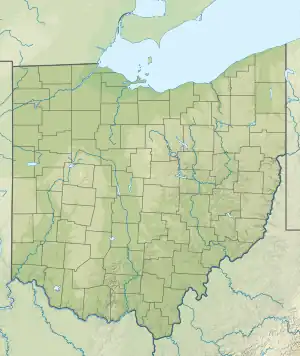 PCW Location of airport in Ohio  PCW PCW (the United States) | |||||||||||||||
| Runways | |||||||||||||||
| |||||||||||||||
| Statistics (2020) | |||||||||||||||
| |||||||||||||||
Erie–Ottawa International Airport,[1] (Carl R. Keller Field) (ICAO: KPCW, FAA LID: PCW) is three miles east of Port Clinton, in Ottawa County, Ohio.[2] It is owned by the Erie–Ottawa Airport Authority.[2] The National Plan of Integrated Airport Systems for 2011–2015 categorized it as a general aviation facility.[3] On November 9, 2013, Erie–Ottawa Airport obtained approval to handle international flights.
Most U.S. airports use the same three-letter location identifier for the FAA and IATA, but this airport has no IATA code.
Facilities
The airport covers 407 acres (165 ha) at an elevation of 590 feet (180 m). It has two asphalt runways: 9/27 is 5,646 by 100 feet (1,721 x 30 m) and 18/36 is 4,002 by 75 feet (1,220 x 23 m).[2]
In the year ending October 21, 2020, the airport had 54,150 aircraft operations, average 148 per day: 74% general aviation, 26% air taxi, and <1% military. 77 aircraft were then based at the airport: 61 single-engine, 9 multi-engine, 6 jet and 1 helicopter.[2]
The airport is home to the Liberty Aviation Museum.
Airlines and destinations
| Airlines | Destinations | Refs |
|---|---|---|
| Griffing Flying Service | Kelleys Island, Middle Bass Island, North Bass Island, Pelee Island, Put-in-Bay, Rattlesnake Island | [4] |
| Island Air Taxi | Put-in-Bay |
See also
References
- 1 2 Erie–Ottawa Regional Airport, official site
- 1 2 3 4 5 FAA Airport Form 5010 for PCW PDF. Federal Aviation Administration. Effective August 10, 2023.
- ↑ "2011–2015 NPIAS Report, Appendix A" (PDF). National Plan of Integrated Airport Systems. Federal Aviation Administration. October 4, 2010. Archived from the original (PDF, 2.03 MB) on 2012-09-27.
- ↑ "Erie Islands | Griffing Flying Service | United States". griffing. Retrieved 2020-11-01.
External links
- Erie–Ottawa International Airport, official site
- Aerial image as of May 1995 from USGS The National Map
- FAA Terminal Procedures for PCW, effective December 28, 2023
- Resources for this airport:
- FAA airport information for PCW
- AirNav airport information for PCW
- FlightAware airport information and live flight tracker
- SkyVector aeronautical chart for PCW