38°30′10″N 90°38′42″W / 38.502736°N 90.645075°W
Eureka, Missouri | |
|---|---|
City | |
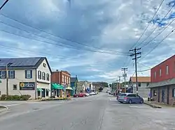
 Eureka's main street | |
 Location of Eureka, Missouri | |
Interactive map outlining Eureka | |
| Coordinates: 38°30′10″N 90°38′42″W / 38.50278°N 90.64500°W | |
| City | Eureka |
| State | Missouri |
| County | St. Louis |
| Government | |
| • Mayor | Sean Flower |
| Area | |
| • Total | 11.22 sq mi (29.06 km2) |
| • Land | 11.05 sq mi (28.62 km2) |
| • Water | 0.17 sq mi (0.44 km2) |
| Elevation | 476 ft (145 m) |
| Population (2020) | |
| • Total | 11,646 |
| • Density | 1,053.75/sq mi (406.85/km2) |
| Time zone | UTC−6 (Central (CST)) |
| • Summer (DST) | UTC−5 (CDT) |
| ZIP code | 63025[3] |
| Area code | 636 |
| FIPS code | 29-22834[4] |
| GNIS feature ID | 2394707[2] |
| Website | City of Eureka official website |
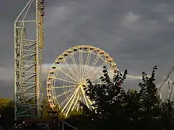
Eureka is a city in St. Louis County and Jefferson County, Missouri, adjacent to Wildwood and Pacific. It is in the extreme southwest of the Greater St. Louis metro area. As of the 2020 census, the city had a population of 11,646.[5] Since 1971, Eureka has been known as the home of the amusement park Six Flags St. Louis.
History

The area's first known inhabitants were Shawnee Native Americans on the banks of the Meramec river; archaeological artifacts can still be found today as evidence of their past occupation of the area.[6]
The village of Eureka was platted in 1858[7] along the route of the Pacific Railroad. By 1890, the village consisted of about 100 homes. According to the Eureka, railroad workers, while clearing the way for the track and the next railroad camp, saw Eureka, level land with little to clear, and declared, "Eureka!" Greek meaning "I have found it."[6] Thus, Eureka was founded. In 1898, Eureka became home to the St. Louis Children's Industrial Farm, established to give children from St. Louis tenement neighborhoods a chance to experience life in a rural setting. It later became Camp Wyman (now part of Wyman Center) and is one of the oldest camps in the United States. The first high school class in Eureka was held in 1909. Eureka was incorporated as a fourth-class city on April 7, 1954.
Historically, Eureka was wholly within St. Louis County. In September 2019, the city's Board of Aldermen voted to annex two commercial lots—one of them a 72.5-acre tract that houses Kirkwood Materials West, a sand and gravel quarry, and the other a 75-acre field, both at highways 109 and FF—located just across the Meramec River in Jefferson County into the city. On October 1, 2019, the city voted to annex the under construction 549-home Windswept Farms subdivision just to the south into the city. Both annexations both voluntary by the owners.[8]
City of Allenton
The railroad town of Allenton is a former community on U.S. Route 66 located (now) at the junction of Interstate 44 and Business Loop 44 in western St. Louis County. In 1985, it was annexed by the city of Eureka. The town is currently rural, with adjacent farmland and forested Ozark ridges. This community was declared blighted by St. Louis County in 1973.
Geography
According to the United States Census Bureau, the city has a total area of 10.45 square miles (27.07 km2), of which 10.35 square miles (26.81 km2) is land, and 0.10 square miles (0.26 km2) is water.[9]
Floods

The city of Eureka has suffered multiple floods, the two most catastrophic being in 2015 and 2017.[10] This caused the city and U.S. Army Corps of Engineers to evaluate a dozen strategic options, from the use of levees and walls, to buyouts of high-risk properties, to the restoration of flood plain as water storage.[11][12] Scientific researchers determined that the flooding was a man-made calamity caused in part by "inaccurate Federal Emergency Management Agency flood frequencies based on the assumption that today's river will behave as it has in the past greatly underestimating our real flood risk and leading to inappropriate development in floodways and floodplains."[13][14]
.jpg.webp)
2015
The december 2015 North American storm complex deeply impacted the state of Missouri with heavy rain and snow causing severe floods. The storm system was responsible for heavy rain that caused severe flooding.[16][17] Parts of the state were hit with over 10 in (250 mm) of heavy rainfall.[18] In Eureka, more than 100 boat rescues were conducted by Eureka Fire Department of people and several pets from the second stories of homes near the Meramec River.[19][20]
2017
A flooding event caused by a strong spring storm system brought multiple rounds of thunderstorms and heavy rain to portions of the Midwest the weekend of April 29–30, 2017.[21] The middle portion of the Mississippi approached historical record flooding. The National Weather Service anticipated a 48.5 ft. crest at Cape Girardeau, Missouri on May 5, 2017, which was within 6 inches of the January 2, 2016 crest of 48.86 ft.[22] The first floor of a church flooded with about 48 inches of water, the same amount as in December 2015. Floodwater from the Meramec River covered athletic fields at Eureka High School, encroached on the school's buildings, and ruined the gymnasium floor.[23]
Demographics
| Census | Pop. | Note | %± |
|---|---|---|---|
| 1880 | 141 | — | |
| 1960 | 1,134 | — | |
| 1970 | 2,384 | 110.2% | |
| 1980 | 3,862 | 62.0% | |
| 1990 | 4,683 | 21.3% | |
| 2000 | 7,676 | 63.9% | |
| 2010 | 10,189 | 32.7% | |
| 2020 | 11,646 | 14.3% | |
| U.S. Decennial Census[5] | |||

2020 census
The 2020 United States census[24] counted 11,646 people, 3,486 households, and 2,575 families in Eureka. The population density was 1,053.9 per square mile (406.9/km2). There were 3,740 housing units at an average density of 338.5 per square mile (130.7/km2). The racial makeup was 90.73% (10,566) white, 0.82% (96) black or African-American, 0.12% (14) Native American, 1.57% (183) Asian, 0.05% (6) Pacific Islander, 0.76% (89) from other races, and 5.94% (692) from two or more races. Hispanic or Latino of any race was 2.1% (211) of the population.
Of the 3,486 households, 40.5% had children under the age of 18; 64.5% were married couples living together; 16.1% had a female householder with no husband present. Of all households, 20.1% consisted of individuals and 11.4% had someone living alone who was 65 years of age or older. The average household size was 2.8 and the average family size was 3.4.
26.4% of the population was under the age of 18, 3.9% from 18 to 24, 20.4% from 25 to 44, 24.1% from 45 to 64, and 12.9% who were 65 years of age or older. The median age was 39.8 years. For every 100 females, the population had 109.5 males. For every 100 females ages 18 and older, there were 98.5 males.
The 2016-2020 5-year American Community Survey[25] estimates show that the median household income was $112,750 (with a margin of error of +/- $13,390) and the median family income was $121,977 (+/- $8,559). Males had a median income of $74,452 (+/- $8,634) versus $47,137 (+/- $8,637) for females. The median income for those above 16 years old was $59,316 (+/- $9,813). Approximately, 0.0% of families and 0.6% of the population were below the poverty line, including 0.0% of those under the age of 18 and 0.8% of those ages 65 or over.
2010 census
As of the 2010 census,[26] there were 10,189 people, 3,474 households, and 2,758 families residing in the city. The population density was 984.4 inhabitants per square mile (380.1/km2). There were 3,683 housing units at an average density of 355.8 per square mile (137.4/km2). The racial makeup of the city was 94.9% White, 0.8% African American, 0.2% Native American, 1.9% Asian, 0.1% Pacific Islander, 0.3% from other races, and 1.7% from two or more races. Hispanic or Latino of any race were 2.0% of the population.
There were 3,474 households, of which 46.9% had children under the age of 18 living with them, 66.2% were married couples living together, 9.3% had a female householder with no husband present, 3.9% had a male householder with no wife present, and 20.6% were non-families. 17.2% of all households were made up of individuals, and 5.9% had someone living alone who was 65 years of age or older. The average household size was 2.87 and the average family size was 3.27.
The median age in the city was 37.1 years. 30.9% of residents were under the age of 18; 6% were between the ages of 18 and 24; 26.6% were from 25 to 44; 26.7% were from 45 to 64, and 9.6% were 65 years of age or older. The gender makeup of the city was 49.6% male and 50.4% female.
2000 census
As of the 2000 census,[4] there were 7,676 people in the city, organized into 2,487 households and two families. Its population density was 763.7 inhabitants per square mile (294.9/km2). There were 2,622 housing units at an average density of 260.9 per square mile (100.7/km2). The racial makeup of the city was 97.38% White, 0.82% Asian, 0.57% Black or African American, 0.20% Native American, no Pacific Islanders, 0.26% from other races, and 0.77% from two or more races. 1.22% of the population were Hispanic or Latino of any race.
There were 2,487 households, out of which half have children under the age of 18 living with them, 71.6% were married couples living together, 8.2% had a female householder with no husband present, and 17.0% were non-families. 13.8% of all households were made up of individuals, and 4.3% had someone living alone who was 65 years of age or older. The average household size was 2.98 and the average family size was 3.30.
In the city, the population was spread out, with 31.9% under the age of 18, 5.7% from 18 to 24, 34.4% from 25 to 44, 19.5% from 45 to 64, and 8.5% 65 years of age or older. The median age was 34 years. For every 100 females, there were 94.9 males. For every 100 females age 18 and over, there were 89.6 males.
The median income for a household in the city was $74,301, and the median income for a family was $80,625. Males had a median income of $51,799 compared to $33,269 for females. The per capita income for the city was $27,553. 2.2% of the population and 1.3% of families were below the poverty line. Out of the total population, 3.1% of those under the age of 18 and 5.9% of those 65 and older were living below the poverty line.
Education
Rockwood R-Vi School District operates 3 elementary schools, Lasalle Springs Middle School and Eureka High School.[27]
The city also contains two private schools, St. Mark's Lutheran Church and School and Most Sacred Heart Church and School.
The city has the Eureka Hills Branch lending library, a branch of the St. Louis County Library.[28] It was moved to a newly built location that opened on June 2, 2021.[29]

News media
Local news coverage for the town and some of its neighbors is provided by the Tri County Journal, the Eureka and Pacific Current NewsMagazine, and the Washington Missourian.
Notable people
- Clayton Echard (Star of The Bachelor Season 26)
- Cam Janssen, National Hockey League player
- Bob Klinger, Major League Baseball player
- Rissi Palmer, Country Western singer
References
- ↑ "ArcGIS REST Services Directory". United States Census Bureau. Retrieved August 28, 2022.
- 1 2 U.S. Geological Survey Geographic Names Information System: Eureka, Missouri
- ↑ "Eureka MO ZIP Code". zipdatamaps.com. 2023. Retrieved January 26, 2023.
- 1 2 "U.S. Census website". United States Census Bureau. Retrieved 2008-01-31.
- 1 2 2020 Census, US Census Bureau, Eureka city, Missouri, Profile
- 1 2 "City History | Eureka, MO". www.eureka.mo.us. Retrieved August 22, 2020.
- ↑ Eaton, David Wolfe (1918). How Missouri Counties, Towns and Streams Were Named. The State Historical Society of Missouri. p. 360.
- ↑ Skaggs, Katelyn Mary (October 12, 2019). "ICYMI: Annexations will cost county millions in lost revenue". Leader Publications. Retrieved September 2, 2023.
- ↑ "US Gazetteer files 2010". United States Census Bureau. Archived from the original on January 12, 2012. Retrieved July 8, 2012.
- ↑ Gray, Bryce (May 8, 2017). "Two catastrophic floods in less than two years wasn't just a case of bad luck". St. Louis Post-Dispatch. Retrieved July 15, 2021.
- ↑ "4 years ago, flooding forced people by the Meramec to 'pick your side'". St. Louis Post-Dispatch. May 3, 2021. Retrieved July 15, 2021.
- ↑ Gray, Bryce (March 20, 2021). "After multiple historic floods, Eureka, region rethink river management". St. Louis Post-Dispatch. Retrieved July 15, 2021.
- ↑ "Record Missouri flooding was manmade calamity, scientist says | The Source | Washington University in St. Louis". The Source. February 5, 2016. Retrieved July 15, 2021.
- ↑ Marso, Andy (March 24, 2019). "Missouri River flooding blamed on Army Corps of Engineers". The Kansas City Star.
- ↑ "USGS Measures Historic Flooding Across the Nation". United States Geological Survey. January 4, 2016. Archived from the original on July 17, 2017. Retrieved July 27, 2022.
- ↑ Eric Sykes (December 29, 2015). "Major flooding in Union, Mo; businesses underwater". Archived from the original on December 1, 2016. Retrieved December 31, 2015.
- ↑ "Missouri Flooding Six Dead". CNN. December 27, 2015.
- ↑ "REPORTS: Severe storms slam Texas as flooding and blizzard conditions struck the Plains". AccuWeather. Archived from the original on July 22, 2019. Retrieved July 15, 2021.
- ↑ "Roadways begin to reopen in flood-ravaged St. Louis area". Fox News. Associated Press. January 1, 2016. Retrieved January 1, 2016.
- ↑ Jacobo, Julia; Manzo, Daniel; Peck, Dan (December 31, 2015). "22 Dead, 2 Missing in Record Flooding Across Midwest". ABC News. Retrieved July 15, 2021.
- ↑ US Department of Commerce, NOAA. "Spring 2017 Flooding Event". www.weather.gov. Retrieved July 15, 2021.
- ↑ Robinson, Zach. "Mississippi River projected to reach record levels after severe storms cause flooding". Retrieved May 1, 2017.
- ↑ "Flooding swamps Midwest". www.usatoday.com. Retrieved July 15, 2021.
- ↑ "Explore Census Data". data.census.gov. Retrieved December 17, 2023.
- ↑ "Explore Census Data". data.census.gov. Retrieved December 17, 2023.
- ↑ "U.S. Census website". United States Census Bureau. Retrieved July 8, 2012.
- ↑ "Rockwood R-Vi School District". Great Schools. Retrieved June 1, 2019.
- ↑ "Eureka Hills Branch Archived September 16, 2009, at the Wayback Machine." St. Louis County Library. Retrieved on August 18, 2009.
- ↑ "New Eureka Hills Branch Opens June 2 | St. Louis County Library".
