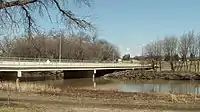
Fargo-Moorhead Toll Bridge | |
|---|---|
 | |
| Coordinates | 46°53′23″N 96°46′28″W / 46.88972°N 96.77444°W |
| Carries | 2 lanes of 12th Ave N/15th Ave N and pedestrian path |
| Crosses | Red River |
| Locale | Fargo, North Dakota Moorhead, Minnesota |
| Other name(s) | Fargo-Moorhead Former Toll Bridge |
| Characteristics | |
| Total length | 535' |
| No. of lanes | 2 |
| History | |
| Opened | 1988 |
| Statistics | |
| Daily traffic | 8,800[1] |
| Location | |
The Fargo-Moorhead Toll Bridge is a former toll bridge on the Red River of the North between Fargo, North Dakota and Moorhead, Minnesota. It connects Moorhead's 15th Avenue N with Fargo's 12th Avenue N.
The bridge was to be privately operated until June 1, 2018, following a five-year extension of its original 25-year charter in 2013.[2][3] In May 2014, The City of Moorhead sued Bridge Co., the owners of the bridge; and the city of Fargo. Judge Frank Racek ruled in favor of the city of Moorhead and that the ownership of the bridge would be transferred to the two cities.[4]
Prior to the 2014 ownership transfer, the bridge had a toll of $0.75.[2]
Flooding

Due to the frequent flooding of the Red river, the bridge is frequently flooded. The bridge is closed when the water level reaches 28',[5] which occurred most recently in spring of 2023. [6]
See also
References
- ↑ "$1.5 Million Grant To Study Replacing Former Toll Bridge in North Fargo/Moorhead". KVRR Local News. 2022-08-09. Retrieved 2023-07-18.
- 1 2 "Fargo Weighs in on Toll Bridge Debate - Valley News Live - KVLY/KXJB - Fargo/Grand Forks". Archived from the original on 2014-02-22. Retrieved 2014-02-07.
- ↑ Alison Voorhees. "KVRR Fox Fargo Moorhead - North Broadway Toll Bridge Closed". Kvrr.com. Retrieved 2017-07-29.
- ↑ "Judge's ruling gives northside toll bridge to Fargo, Moorhead". Wday.com. Retrieved 2017-07-29.
- ↑ "The City of Fargo - Red River Levels". fargond.gov. Retrieved 2023-07-16.
- ↑ "Bridge now closed between Fargo and north Moorhead". InForum. 2023-04-19. Retrieved 2023-07-16.