Ghatshila subdivision | |
|---|---|
Subdivision | |
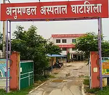
 On the way to Dharagiri Falls, Ghatshila | |
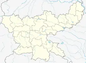
 Ghatshila subdivision Location in Jharkhand, India  Ghatshila subdivision Ghatshila subdivision (India) | |
| Coordinates: 22°34′48″N 86°27′15″E / 22.5801°N 86.4543°E | |
| Country | |
| State | Jharkhand |
| District | Purbi Singhbhum |
| Headquarters | Ghatshila |
| Area | |
| • Total | 2,094.79 km2 (808.80 sq mi) |
| Population | |
| • Total | 682,217 |
| • Density | 330/km2 (840/sq mi) |
| Languages | |
| • Official | Hindi, Urdu |
| Time zone | UTC+5:30 (IST) |
| Website | jamshedpur |
Ghatshila subdivision is an administrative subdivision of the East Singhbhum district in the Kolhan division in the state of Jharkhand, India.
Administration
The district consists of two subdivisions - (1) Dhalbhum subdivision with Patamda, Boram, Golmuri-cum-Jugsalai and Potka CD blocks, and (2) Ghatshila subdivision with Ghatshila, Dhalbhumgarh, Musabani, Dumaria, Gurbandha, Chakulia and Baharagora CD blocks.[1]
The subdivisions of Purbi Singhbhum district have the following distinctions:[2]
| Subdivision | Headquarters | Area km2 | Population (2011) | Rural Population % (2011) | Urban Population % (2011) |
|---|---|---|---|---|---|
| Dhalbhum | Jamshedpur | 1,460.73 | 1,611,702 | 27.53 | 72.47 |
| Ghatshila | Ghatshila | 2,094.79 | 682,217 | 86.78 | 13.22 |
Note: Calculated on the basis of block-wise data available.
M: municipality, R: rural/ urban centre, CT: census town, T: tourist centre
Owing to space constraints in the small map, the actual locations in a larger map may vary slightly
Police stations
Police stations in the Ghatshila subdivision are at:[3]
Blocks
Community development blocks in the Ghatshila subdivision are:[2]
| CD Block | Headquarters | Area km2 | Population (2011) | SC % | ST % | Literacy Rate % | CT |
|---|---|---|---|---|---|---|---|
| Ghatshila | Ghatshila | 349.12 | 129,905 | 6.52 | 42.08 | 70.72 | Ghatshila |
| Musabani | Musabani | 239.00 | 107,084 | 5.51 | 46.35 | 70.94 | Jadugora, Musabani |
| Dhalbhumgarh | Dhalbhumgarh | 176.85 | 61,932 | 5.57 | 54.38 | 62.75 | - |
| Dumaria | Dumaria | 316.74 | 62,128 | 5.57 | 71.88 | 57.11 | - |
| Chakulia | Chakuliya | 412.81 | 108,810 | 2.89 | 51.24 | 64.35 | - |
| Gurbandha | Gurbandha | 229.07 | 43,001 | 3.33 | 66.59 | 55.05 | - |
| Baharagora | Baharagora | 351.10 | 153,051 | 6.84 | 35.91 | 64.45 | - |
Education
In 2011, in Ghatshila subdivision out of a total 1,086 inhabited villages in 7 CD blocks there were 80 villages with pre-primary schools, 768 villages with primary schools, 281 villages with middle schools, 51 villages with secondary schools, 11 villages with senior secondary schools, 4 villages with general degree colleges, 304 villages with no educational facility.[4]
The 4 census towns + 1 nagar panchayat had 54 primary schools, 30 middle schools, 21 secondary schools, 11 senior secondary schools, 6 general degree colleges. (Census towns are normally considered to be a part of the CD block but it is not clear where these are being considered here).[4]
.*Senior secondary schools are also known as Inter colleges in Jharkhand.
Educational institutions
The following institutions are located in Ghatshila subdivision:
- Ghatshila College was established at Ghatshila in 1961.[5]
- Baharagora College was established at Baharagora in 1969.[6]
- Shibu Ranjan Khan Memorial Degree College was established at Chakuliya in 2010.[7]
- BDSL Mahila College, Ghatsila was established at Ghatsila in 1982.[8]
(Information about degree colleges with proper reference may be added here)
Healthcare
In 2011, in Ghatshia subdivision, in the 7 CD blocks, there were 9 villages with primary health centres, 68 villages with primary health subcentres, 23 villages with maternity and child welfare centres, 5 villages with allopathic hospitals, 11 villages with dispensaries, 1 village with a veterinary hospital, 27 villages with family welfare centres, 38 villages with medicine shops.[4]

The 4 census towns + 1 nagar panchayat had 7 hospitals, 7 nursing homes, 84 dispensaries, 171 maternity and child welfare centres, 45 medicine shops. (Census towns are normally considered to be a part of the CD block but it is not clear where these are being considered here).
.*Private medical practitioners, alternative medicine etc. not included
Medical facilities
(Anybody having referenced information about location of government/ private medical facilities may please add it here)
References
- ↑ "East Singhbhum". Subdivisions and blocks. East Singhbhum district administration. Retrieved 29 December 2021.
- 1 2 "District Census Handbook, Purbi Singhbhum, Series 21, Part XII B" (PDF). Pages 26-27: District primary census abstract, 2011 census. Directorate of Census Operations Jharkhand. Retrieved 29 December 2021.
- ↑ "District Police Profile – east-singhbhum". Jharkhand Police. Retrieved 30 December 2021.
- 1 2 3 "District Census Handbook, Purbi Singhbhum, Series 21, Part XII A" (PDF). Pages 777-778, 867-868. Directorate of Census Operations Jharkhand. Retrieved 30 December 2021.
- ↑ "Ghatshila College". University Dunia. Retrieved 30 December 2021.
- ↑ "Baharagora College". BC. Retrieved 30 December 2021.
- ↑ "Our Journey in a Jiffy". Southeast Chemicals. Retrieved 30 December 2021.
- ↑ "B.D.S.L INTER MAHILA COLLEGE - Kashida, District Purbi Singhbhum (Jharkhand)". schools.org.in. Retrieved 2022-02-13.