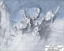
Map of Mount Murphy showing Grew Peak
Grew Peak (75°18′S 110°37′W / 75.300°S 110.617°W) is a peak over 1,400 metres (4,600 ft) high, one of several named peaks on the Mount Murphy massif in Marie Byrd Land, Antarctica. The feature is located on the northeast spur of the massif, between Benedict Peak and the loftier summit peaks. It was mapped by the United States Geological Survey from surveys and U.S. Navy air photos, 1959–66, and was named by the Advisory Committee on Antarctic Names for Edward Grew, a U.S. Exchange Scientist to the Soviet Molodyozhnaya Station in 1973.[1]
References
- ↑ "Grew Peak". Geographic Names Information System. United States Geological Survey, United States Department of the Interior. Retrieved 2012-05-07.
![]() This article incorporates public domain material from "Grew Peak". Geographic Names Information System. United States Geological Survey.
This article incorporates public domain material from "Grew Peak". Geographic Names Information System. United States Geological Survey.
This article is issued from Wikipedia. The text is licensed under Creative Commons - Attribution - Sharealike. Additional terms may apply for the media files.