Guirrari غيراري | |
|---|---|
Town | |
 | |
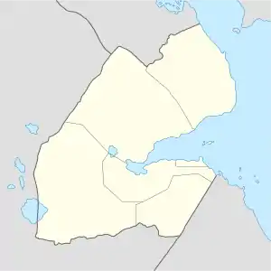 Guirrari غيراري Location in Djibouti | |
| Coordinates: 12°03′N 42°47′E / 12.050°N 42.783°E | |
| Country | |
| Region | Tadjourah |
| Elevation | 831 m (2,726 ft) |
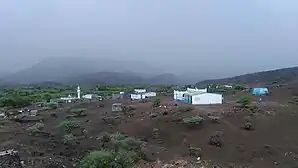
Guirrari (Arabic: غيراري) is a town in the northern Tadjourah region of Djibouti. Its population, with the nomadic and semi-nomadic neighborhoods is estimated at 500 people.
Agriculture
Guirrari is noted for its agricultural and farming industry. Crops grown in the area include vegetables and fruits. Significant investments have been made in the industry.
Climate
Guirrari has a hot arid climate (BWh) by the Köppen-Geiger system.
| Climate data for Guirrari | |||||||||||||
|---|---|---|---|---|---|---|---|---|---|---|---|---|---|
| Month | Jan | Feb | Mar | Apr | May | Jun | Jul | Aug | Sep | Oct | Nov | Dec | Year |
| Mean daily maximum °C (°F) | 24.7 (76.5) |
24.9 (76.8) |
26.9 (80.4) |
28.9 (84.0) |
32.1 (89.8) |
35.3 (95.5) |
35.9 (96.6) |
35.0 (95.0) |
33.1 (91.6) |
29.7 (85.5) |
26.8 (80.2) |
25.0 (77.0) |
29.9 (85.7) |
| Mean daily minimum °C (°F) | 14.2 (57.6) |
15.7 (60.3) |
17.6 (63.7) |
19.6 (67.3) |
22.1 (71.8) |
25.0 (77.0) |
24.7 (76.5) |
24.1 (75.4) |
23.8 (74.8) |
19.9 (67.8) |
17.0 (62.6) |
15.5 (59.9) |
19.9 (67.9) |
| Average rainfall mm (inches) | 28 (1.1) |
27 (1.1) |
19 (0.7) |
23 (0.9) |
12 (0.5) |
6 (0.2) |
20 (0.8) |
31 (1.2) |
31 (1.2) |
12 (0.5) |
32 (1.3) |
24 (0.9) |
265 (10.4) |
| Source: Climate-Data.org, altitude: 841 metres or 2,760 feet[1] | |||||||||||||
References
- ↑ "Climate: Guirrari - Climate graph, Temperature graph, Climate table". Climate-Data.org. Retrieved 25 September 2015.
This article is issued from Wikipedia. The text is licensed under Creative Commons - Attribution - Sharealike. Additional terms may apply for the media files.