Hajjilar
Persian: حاجيلار | |
|---|---|
Village | |
 Hajjilar | |
| Coordinates: 38°51′58″N 45°05′37″E / 38.86611°N 45.09361°E[1] | |
| Country | |
| Province | West Azerbaijan |
| County | Chaypareh |
| District | Hajjilar |
| Rural District | Hajjilar-e Jonubi |
| Population (2016)[2] | |
| • Total | 1,394 |
| Time zone | UTC+3:30 (IRST) |
Hajjilar (Persian: حاجيلار, also Romanized as Ḩājjīlār, Hājī Lār, and Ḩājjīlar; also known as Ḩājalār)[3] is a village in, and the capital of, Hajjilar-e Jonubi Rural District of Hajjilar District of Chaypareh County, West Azerbaijan province, Iran,[4] and also serves as capital of the rural district.[5]
At the 2006 National Census, its population was 1,291 in 370 households, when it was in Hajjilar Rural District of the former Chaypareh District of Khoy County.[6] The following census in 2011 counted 1,560 people in 428 households,[7] by which time the district had been separated from the county in the establishment of Chaypareh County.[4] The latest census in 2016 showed a population of 1,394 people in 434 households; it was the largest village in its rural district.[2]
References
- ↑ OpenStreetMap contributors (5 March 2023). "Hajjilar, Chaypareh County" (Map). OpenStreetMap. Retrieved 5 March 2023.
- 1 2 "Census of the Islamic Republic of Iran, 1395 (2016)". AMAR (in Persian). The Statistical Center of Iran. p. 04. Archived from the original (Excel) on 30 August 2022. Retrieved 19 December 2022.
- ↑ Hajjilar can be found at GEOnet Names Server, at this link, by opening the Advanced Search box, entering "-3065605" in the "Unique Feature Id" form, and clicking on "Search Database".
- 1 2 Davodi, Parviz (18 September 1386). "Approval letter regarding reforms of country divisions in West Azerbaijan province". Islamic Parliament Research Center (in Persian). Ministry of Interior, Political-Defense Commmission. Archived from the original on 13 April 2014. Retrieved 21 November 2023.
- ↑ Mousavi, Mirhossein (2 February 1366). "Creation and formation of 12 rural districts including villages, farms and places located in Khoy County of West Azerbaijan province". Islamic Parliament Research Center (in Persian). Ministry of Interior, Board of Ministers. Archived from the original on 4 August 2014. Retrieved 23 December 2023.
- ↑ "Census of the Islamic Republic of Iran, 1385 (2006)". AMAR (in Persian). The Statistical Center of Iran. p. 04. Archived from the original (Excel) on 20 September 2011. Retrieved 25 September 2022.
- ↑ "Census of the Islamic Republic of Iran, 1390 (2011)". Syracuse University (in Persian). The Statistical Center of Iran. p. 04. Archived from the original (Excel) on 20 January 2023. Retrieved 19 December 2022.
West Azerbaijan province, Iran | ||
|---|---|---|
| Capital | 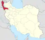 | |
| Counties and cities | ||
| Tourism | ||
| Places | ||
| Capital | |||||||||||||||||||||
|---|---|---|---|---|---|---|---|---|---|---|---|---|---|---|---|---|---|---|---|---|---|
| Districts |
| ||||||||||||||||||||