Highfield | |
|---|---|
 Craighead Diocesan School | |
| Coordinates: 44°23′23″S 171°13′08″E / 44.389716°S 171.218902°E | |
| Country | New Zealand |
| City | Timaru |
| Local authority | Timaru District Council |
| Electoral ward | Timaru |
| Area | |
| • Land | 236 ha (583 acres) |
| Population (June 2022)[2] | |
| • Total | 3,600 |
| Marchwiel | Waimataitai | |
| Glenwood |
|
Maori Hill |
| West End |
Highfield is a suburb of Timaru, in the South Canterbury district and Canterbury region of New Zealand's South Island.
Economy
Retail
The Highfield Village Mall includes a New World supermarket.[3]
Demographics
Highfield covers 2.36 km2 (0.91 sq mi).[1] It had an estimated population of 3,600 as of June 2022, with a population density of 1,525 people per km2.
| Year | Pop. | ±% p.a. |
|---|---|---|
| 2006 | 3,528 | — |
| 2013 | 3,420 | −0.44% |
| 2018 | 3,609 | +1.08% |
| Source: [4] | ||
Highfield North, comprising the statistical areas of Highfield North and Highfield South, had a population of 3,609 at the 2018 New Zealand census, an increase of 189 people (5.5%) since the 2013 census, and an increase of 81 people (2.3%) since the 2006 census. There were 1,473 households. There were 1,650 males and 1,959 females, giving a sex ratio of 0.84 males per female, with 600 people (16.6%) aged under 15 years, 546 (15.1%) aged 15 to 29, 1,545 (42.8%) aged 30 to 64, and 924 (25.6%) aged 65 or older.
Ethnicities were 91.2% European/Pākehā, 6.5% Māori, 1.4% Pacific peoples, 4.3% Asian, and 2.6% other ethnicities (totals add to more than 100% since people could identify with multiple ethnicities).
The proportion of people born overseas was 14.7%, compared with 27.1% nationally.
Although some people objected to giving their religion, 45.7% had no religion, 45.0% were Christian, 0.7% were Hindu, 0.2% were Muslim, 0.4% were Buddhist and 1.5% had other religions.
Of those at least 15 years old, 555 (18.4%) people had a bachelor or higher degree, and 636 (21.1%) people had no formal qualifications. The employment status of those at least 15 was that 1,308 (43.5%) people were employed full-time, 486 (16.2%) were part-time, and 78 (2.6%) were unemployed.[4]
| Name | Area (km2) | Population | Density (per km2) | Households | Median age | Median income |
|---|---|---|---|---|---|---|
| Highfield North | 1.41 | 2,358 | 1,672 | 963 | 51.1 years | $28,400[5] |
| Highfield South | 0.95 | 1,251 | 1,317 | 510 | 40.8 years | $30,400[6] |
| New Zealand | 37.4 years | $31,800 |
Education
Highfield School is a coeducational primary serving years 1 to 8[7] with a roll of 277. The school was established in 1962.[8]
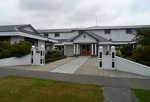
Craighead Diocesan School is a statae-integrated girls' secondary school serving years 7 to 13[9] with a roll of 414. The school was established in 1911, and became an Anglican Church school in 1926.[10]
Rolls are as of April 2023.[11]
References
- 1 2 "ArcGIS Web Application". statsnz.maps.arcgis.com. Retrieved 15 November 2021.
- ↑ "Population estimate tables - NZ.Stat". Statistics New Zealand. Retrieved 25 October 2022.
- ↑ "Highfield Village Mall". southcanterbury.org.nz. South Canterbury Chamber of Commerce.
- 1 2 "Statistical area 1 dataset for 2018 Census". Statistics New Zealand. March 2020. Highfield North (340400) and Highfield South (340500).
- ↑ 2018 Census place summary: Highfield North
- ↑ 2018 Census place summary: Highfield South
- ↑ Education Counts: Highfield School
- ↑ "Highfield School Prospectus" (PDF). Highfield School. 2021.
- ↑ Education Counts: Craignhead Diocesan School
- ↑ "From Our Beginning". Craighead Diocesan School. Retrieved 15 November 2021.
- ↑ "New Zealand Schools Directory". New Zealand Ministry of Education. Retrieved 12 December 2022.