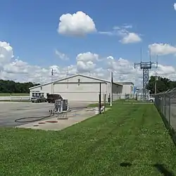
Highland County Airport | |||||||||||
|---|---|---|---|---|---|---|---|---|---|---|---|
| Summary | |||||||||||
| Airport type | Public | ||||||||||
| Owner | Highland County Commissioners | ||||||||||
| Serves | Hillsboro, Ohio | ||||||||||
| Elevation AMSL | 977 ft / 298 m | ||||||||||
| Coordinates | 39°11′19″N 083°32′19″W / 39.18861°N 83.53861°W | ||||||||||
| Map | |||||||||||
 HOC Location of airport in Ohio  HOC HOC (the United States) | |||||||||||
| Runways | |||||||||||
| |||||||||||
| Statistics (2021) | |||||||||||
| |||||||||||
Highland County Airport (ICAO: KHOC, FAA LID: HOC) is a public-owned, public-use airport located at 9500 North Shore Drive three nautical mile (4.8 km) southeast of the central business district of the city of Hillsboro, in Highland County, Ohio, United States.[1]
Although many U.S. airports use the same three-letter location identifier for the FAA and IATA, this airport is assigned HOC by the FAA but has no designation from the IATA[2] (which assigned HOC to Komako Airport in Komako, Papua New Guinea[3]).
Gallery
 Main office terminal
 Airplane hangars
 Hangar 6 Inc.
 Hangar 6 Inc.
 Security building
Facilities and aircraft
Highland County Airport covers an area of 15 acres (6.1 ha) at an elevation of 977 feet (298 m) above mean sea level. It has one asphalt paved runway: 05/23 is 3,520 by 75 feet (1,073 x 23 m).[1]
For the 12-month period ending December 31, 2021, the airport had 9,125 aircraft operations, an average of 25 per day: 98% general aviation, 3% military, and <1% air taxi. At that time there were 16 aircraft based at this airport, all single-engine airplanes.[1][4]
The airport has a fixed-base operator that sells avgas.[5]
Accidents and incidents
- On April 8, 1997, a Cessna 414 impacted trees and terrain while on approach to the Highland County Airport. The pilot, a professor at the University of Cincinnati, was taking one of his students for a ride to the Highland County Airport. Witnesses report the plane turned towards the airport but that it appeared the pilot was having difficulty stabilizing the aircraft, with another observing the plane in a 90-degree bank. The pilot appeared to be attempting to correct the situation but was ultimately unable. The probable cause of the accident was found to be the failure of the pilot to maintain adequate airspeed, while maneuvering, which resulted in an advertent stall and collision with trees, vehicles, and the terrain.[6][7]
- On May 30, 2008, a Piper Cherokee crashed after departure from the Highland County airport. Witnesses report it struck several trees, caught fire, and crashed in a field. Witnesses say the airplane took off and maintained 300-400 feet before smoke began flowing from the right side of the aircraft. The aircraft then banked, descended, and struck the trees. The probable cause of the accident was found to be the pilot's failure to maintain control of the airplane due to an in-flight fire as a result of a corrosion hole in the muffler that was not identified by the mechanic. Contributing to the accident was the improper emergency procedure performed for an in-flight fire.[8][9][10]
- On April 1, 2010, a single-engine Cessna 172 crashed at the airport while attempting to land. A witness reported observing the aircraft turning toward the airport at a low altitude. Another heard the sound of an airplane "throttling up" followed by the sound of a crash a few seconds later. The reason for the impact with the runway could not be determined, though the pilot's wife told authorities she feared her husband had been suicidal.[11][12]
- On June 15, 2018, a Piper PA-22 crashed during landing at the Highland County Airport. During the landing roll, the aircraft exited the runway to the left, struck a runway light and impacted a ditch. The left main landing gear separated from the airplane and the airplane came to rest nose down. The pilot added that, while he was at the departure airport prior to the flight, jet blast blew him off a ladder during the preflight inspection, and the airplane's tail section was "picked up" and slammed onto the ground multiple times. He examined the airplane and did not find any anomalies. The probable cause of the accident was found to be the pilot’s failure to maintain directional control during landing.[13][14]
See also
References
- 1 2 3 4 FAA Airport Form 5010 for HOC PDF, effective 2009-05-22.
- ↑ "Highland County Airport (ICAO: KHOC, FAA: HOC)". Great Circle Mapper. Retrieved 29 May 2010.
- ↑ "Komako Airport HOC (IATA: HOC)". Great Circle Mapper. Retrieved 29 May 2010.
- ↑ "AirNav: KHOC - Highland County Airport". www.airnav.com. Retrieved 2023-12-08.
- ↑ "Highland County Airport FBO Info & Fuel Prices at Highland County (KHOC)". FlightAware. Retrieved 2023-12-08.
- ↑ "Cessna 414 crash in Ohio (N13MN) | PlaneCrashMap.com". planecrashmap.com. Retrieved 2023-12-08.
- ↑ "Accident Cessna 414 N13MN,". Aviation Safety Network. Flight Safety Foundation. Retrieved 2023-12-08.
- ↑ "UPDATE: Victims of Highland County plane crash ID'd". FOX 19. 2008-05-30. Retrieved 2023-12-08.
- ↑ "2 die in Highland County plane crash". The Columbus Dispatch. Retrieved 2023-12-08.
- ↑ "Piper PA28 crash in Ohio (N9376W) | PlaneCrashMap.com". planecrashmap.com. Retrieved 2023-12-08.
- ↑ "Pilot killed in Highland County plane crash". The Columbus Dispatch. Retrieved 2023-12-08.
- ↑ "Cessna 172D crash in Ohio (N2190Y) | PlaneCrashMap.com". planecrashmap.com. Retrieved 2023-12-08.
- ↑ "Piper Pa 22 crash in Ohio (N8273C) | PlaneCrashMap.com". planecrashmap.com. Retrieved 2023-12-08.
- ↑ "Piper PA-22-135 Tri-Pacer, N8273C: Accident occurred June 15, 2018 at Highland County Airport (KHOC), Hillsboro, Ohio". Kathryn's Report. Retrieved 2023-12-08.
External links
- FAA Terminal Procedures for HOC, effective December 28, 2023
- Resources for this airport:
- FAA airport information for HOC
- AirNav airport information for HOC
- FlightAware airport information and live flight tracker
- SkyVector aeronautical chart for HOC