| Hope River | |
|---|---|
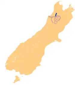
 location of Hope River | |
| Location | |
| Country | New Zealand |
| Physical characteristics | |
| Source | |
| • location | Hope Range |
| Mouth | |
• location | Buller River |
• elevation | 350 m (1,150 ft) |
| Basin features | |
| Progression | North - South |
| Tributaries | |
| • left | Little Hope River |
The Hope River is in the Tasman District of the South Island of New Zealand. It is the northernmost of three Hope Rivers in the South Island.

The river rises on the eastern slopes of the Hope Range at heights of around 1,200 metres (3,900 ft). It flows east then south before joining the Buller River near Kawatiri Railway Station. A tributary called the Little Hope River rises near the Hope Saddle and flows southwest, joining the Hope River at Glenhope.[1] State Highway 6 follows the valley of the Hope and then the Little Hope as it climbs towards the Hope Saddle en route to Nelson.
The river was named after G. W. Hope, who was secretary to Edward, Lord Stanley, the 14th Earl of Derby who later became Prime Minister of Great Britain.[2]
References
41°41′25.71″S 172°37′3.73″E / 41.6904750°S 172.6177028°E