| Horton Creek | |
|---|---|
 | |
| Location | |
| Country | United States |
| State | Arizona |
| Physical characteristics | |
| Source | |
| • location | spring |
| • elevation | 6,700 ft (2,000 m) |
| Mouth | |
• location | confluence with Tonto Creek |
• elevation | 5,400 ft (1,600 m) |
Horton Creek is located in the Mogollon Rim area of the state of Arizona. The closest town Payson is 20 miles (32 km) away. The facilities are maintained by Tonto National Forest division of the USDA Forest Service.

Horton Creek Trailhead off the Zane Grey Highway where Horton Creek enters Tonto Creek.

Horton Creek Trail passing through a forest of Arizona Ponderosa Pine.

Horton Creek, Arizona in December.
Fish species

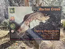
Horton Creek, Arizona fishing regulations.
References
- Information and Education Division (2007), Arizona Fishin' Holes, Phoenix, AZ: Arizona Game and Fish Department
External links
This article is issued from Wikipedia. The text is licensed under Creative Commons - Attribution - Sharealike. Additional terms may apply for the media files.