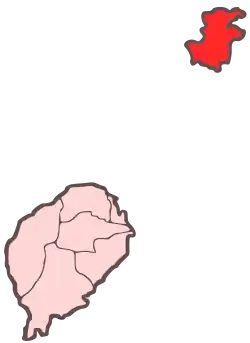
 Map of São Tomé and Príncipe with Ilhéu Caroço southeast of the island of Príncipe | |
| Geography | |
|---|---|
| Location | southeast of the island of Príncipe, São Tomé and Príncipe |
| Coordinates | 1°30′50″N 7°25′52″E / 1.514°N 7.431°E |
| Area | 0.4 km2 (0.15 sq mi) |
| Highest elevation | 305 m (1001 ft) |
| Administration | |
| Demographics | |
| Population | 0 |
Ilhéu Caroço, also called Ilhéu Boné de Jóquei, which translates to Jokey Cap Island,[1] is an uninhabited islet in the Gulf of Guinea, part of São Tomé and Príncipe. The islet is located southeast of the island of Príncipe, about 2.5 km off the coast.[2] Its area is about 0.4 km2. The islet is steep, rocky and wooded, and rises to 305 metres elevation.[3] Just off the coast is another much smaller islet.[4]
References
- ↑ "Roça Sundy Príncipe Island - Unseen Tropical Wilderness On The Island Of Príncipe". uniqhotels.com. Retrieved 2023-08-28.
- ↑ "Turismo São Tomé e Príncipe". visitsaotomeprincipe.st. Retrieved 2023-08-28.
- ↑ Sailing Directions (Enroute), Pub. 123: Southwest Coast of Africa (PDF). Sailing Directions. United States National Geospatial-Intelligence Agency. 2017. p. 74.
- ↑ inyathi (2008-03-02), The Jockey's Cap Principe, São Tomé & Príncipe, retrieved 2023-08-23
This article is issued from Wikipedia. The text is licensed under Creative Commons - Attribution - Sharealike. Additional terms may apply for the media files.
