Jembrana Regency
Kabupaten Jembranaᬓᬩᬸᬧᬢᬾᬦ᭄ᬚᬾᬫ᭄ᬭᬦKabupatén Jĕmbrana | |
|---|---|
 Seal | |
| Motto: Tri Ananta Bhakti | |
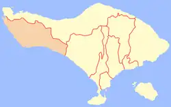 Location within Bali | |
| Country | |
| Province | |
| Capital | Negara |
| Government | |
| • Regent | I Nengah Tamba |
| Area | |
| • Total | 325.0 sq mi (841.8 km2) |
| Population (mid 2022 estimate)[1] | |
| • Total | 327,850 |
| • Density | 1,000/sq mi (390/km2) |
| Time zone | UTC+8 (ICST) |
| Area code | (+62) 365 |
| Website | jembranakab.go.id |
Jembrana Regency is a regency (kabupaten) in the southwest of Bali, Indonesia. It has an area of 841.8 km2 and had a population of 261,638 at the 2010 Census[2] and 317,064 at the 2020 Census;[3] the official estimate as at mid 2022 was 327,850.[1] Its regency seat is the town of Negara.
Administrative districts
The Regency is divided into five districts (kecamatan), listed below from west to east with their areas and their populations at the 2010 Census[2] and the 2020 Census,[3] together with the official estimates as at mid 2022.[1] The table also includes the locations of the district administrative centres, the number of administrative villages in each district (totaling 41 rural desa and 10 urban kelurahan), and its postal codes.
| Kode Wilayah | Name of District (kecamatan) | Area in km2 | Pop'n 2010 Census | Pop'n 2020 Census | Pop'n mid 2022 Estimate | Admin centre | No. of villages | Post code |
|---|---|---|---|---|---|---|---|---|
| 51.01.04 | Melaya (a) | 197.19 | 50,381 | 61,494 | 63,670 | Melaya | 10 (b) | 82252 |
| 51.01.01 | Negara | 126.50 | 77,812 | 95,539 | 99,290 | Baler Bale Agung | 12 (c) | 82218 (d) |
| 51.01.05 | Jembrana (district) | 93.97 | 51,634 | 61,812 | 63,760 | Dauhwaru | 10 (c) | 82218 (e) |
| 51.01.02 | Mendoyo | 294.49 | 56,222 | 67,536 | 69,710 | Pergung | 11 (b) | 82261 |
| 51.01.03 | Pekutatan | 129.65 | 25,583 | 30,483 | 31,420 | Pekutatan | 8 | 82262 |
| Totals | 841.80 | 261,638 | 317,064 | 327,850 | Negara | 51 | ||
Notes: (a) including the small offshore islands of Pulau Buring and Pulau Kalong. (b) including 1 kelurahan. (c) including 4 kelurahan.
(d) except four villages with different post codes - Baler Bale Agung (62212), Banjar Tengah (62213), Lelateng (62214) and Loloan Barat (62215).
(e except the villages of Pendem (62211) and Loloan Timur (62216).
References
External links
 Negara travel guide from Wikivoyage
 Media related to Jembrana Regency at Wikimedia Commons
- (in Indonesian) Official website
8°18′S 114°40′E / 8.300°S 114.667°E