Jhanjharpur | |
|---|---|
Town | |
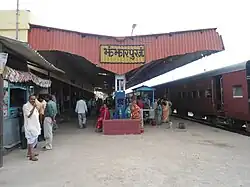
 Jhanjharpur Railway Station | |
 Jhanjharpur Location in Bihar, India | |
| Coordinates: 26°16′N 86°17′E / 26.27°N 86.28°E | |
| Country | |
| State | Bihar |
| District | Madhubani |
| Elevation | 59 m (194 ft) |
| Population (2001) | |
| • Total | 24,102 |
| Languages | |
| • Official | Maithili, Hindi |
| Time zone | UTC+5:30 (IST) |
| Lok Sabha constituency | Jhanjharpur |
| Vidhan Sabha constituency | Jhanjharpur |
Jhanjharpur is a town and a sub-division in the Madhubani district of the state of Bihar, India. Jhanjharpur is well connected to the other cities of India with railways.
Jhanjharpur town is connected with, Kamla Balan bridge, a century-old 220 ft bridge built by the British in the early 1900s,[1] being a rail-cum-road bridge (first rail-cum-road bridge in India) It facilitates the movement of dozen of trains and hundreds of vehicles every day to and from Jhanjharpur.
The nearest airport is Darbhanga Airport which is 48 km away from Jhanjharpur. People can also take their flights for the different cities of India from the Lok Nayak Jayprakash Narayan International Airport which is 191 km away from Jhanjharpur and present in the capital city of Bihar "Patna".
Trade
Laukaha is a nearby town close to the border of Nepalese town of Thadi. Laukaha in India and Thadi in Nepal are a part of one of the agreed route for Mutual Trade between India and Nepal.[2] Nepal Government of Nepal has set up a dedicated customs office in the town.[3] and Government of India has set up a Land Customs Station with a Superintendent level officer.[4]
References
- ↑ Balan, Kamla (17 September 2008). "Kamla Balan". live mint. No. september. live mint. live mint. Retrieved 1 June 2019.
- ↑ "India Nepal Trade Agreement. India-Nepal Foreign Treaty of Trade Agreement". www.eximguru.com. Retrieved 12 September 2019.
- ↑ "Department of Customs, Nepal – Custom Contact Offices". www.customs.gov.np. Retrieved 12 September 2019.
- ↑ "No. |".