| Johan Petersen Fjord | |
|---|---|
| Petersen Bugt | |
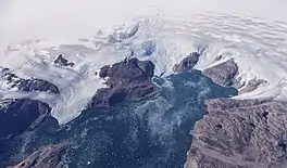
 View of Johan Petersen Fjord from the air. NASA HU-25 Falcon picture. | |
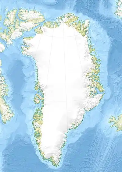
 Johan Petersen Fjord Location in Greenland | |
| Location | East Greenland |
| Coordinates | 65°53′N 38°17′W / 65.883°N 38.283°W |
| Ocean/sea sources | Denmark Strait North Atlantic Ocean |
| Basin countries | Greenland |
| Max. length | 20 km (12 mi) |
| Max. width | 4 km (2.5 mi) |
| References | [1] |
Johan Petersen Fjord, also known as Petersen Bay (Danish: Petersen Bugt),[2] is a fjord in King Christian IX Land, Eastern Greenland. The fjord is named after Danish Arctic explorer Johan Petersen (1813–1880).
Geography
This fjord is located on the western shore of Sermilik (Sermiligaaq), near Tasiilaq (Ammassalik), about 20 km (12 mi) north of the mouth of the great fjord.[2] Johan Petersen Fjord runs roughly from northwest to southeast for about 20 km (12 mi). The Bruckner[3] and Heim[4] glaciers discharge at the head of the fjord.[1]
Qeertartivatsiaq Island is located on the northern side of the entrance of the fjord. There are Inuit ruins on the southern shore of the island facing the fjord.[2]
Bibliography
- Spencer Apollonio, Lands That Hold One Spellbound: A Story of East Greenland, 2008
See also
References
- 1 2 GoogleEarth
- 1 2 3 "Johan Petersen Fjord". Mapcarta. Retrieved 11 October 2019.
- ↑ "Brückner Gletscher". Mapcarta. Retrieved 12 October 2019.
- ↑ "Heim Gletscher". Mapcarta. Retrieved 11 October 2019.
External links
- Den grønlandske Lods - Geodatastyrelsen Archived 2020-10-28 at the Wayback Machine
- East Greenland: Exploring Johan Petersen Fjord
This article is issued from Wikipedia. The text is licensed under Creative Commons - Attribution - Sharealike. Additional terms may apply for the media files.