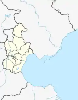
Junliangcheng Subdistrict
军粮城街道 | |
|---|---|
.png.webp) Location in Dongli District | |
 Junliangcheng Subdistrict  Junliangcheng Subdistrict | |
| Coordinates: 39°03′30″N 117°27′03″E / 39.05833°N 117.45083°E | |
| Country | China |
| Municipality | Tianjin |
| District | Dongli |
| Village-level Divisions | 10 communities |
| Area | |
| • Total | 33.12 km2 (12.79 sq mi) |
| Elevation | 3 m (10 ft) |
| Population (2010) | |
| • Total | 52,112 |
| • Density | 1,600/km2 (4,100/sq mi) |
| Time zone | UTC+8 (China Standard) |
| Postal code | 300301 |
| Area code | 022 |
Junliangcheng Subdistrict (simplified Chinese: 军粮城街道; traditional Chinese: 軍糧城街道; pinyin: Jūnliángchéng Jiēdào) is a subdistrict situated inside of Dongli District, Tianjin, China. It shares a border with Huaming and Donglihu Subdistricts to the north, Beitang and Xinhe Subdistricts in the east, Hujiayuan and Wuxia Subdistircts in the southeast, and Jinqiao Subdistrict in the southwest. The subdistrict has a population of 52,112 in the year 2010.[1]
At the time of the Tang dynasty, the imperial government set up a series of defenses in today's Beijing, Tianjin and Hebei to deter invasions from Kumo Xi and Khitan. A granary was built along the Hai River to supply the defending troops. During the Song dynasty, the area around was referred to as Juliangcheng (Chinese: 聚粮城; lit. 'Gather Grain Fort'), which later evolved to the name of Junliangcheng today.[2]
History
| Year | Status | Within |
|---|---|---|
| 1948 - 1958 | Junliangcheng Town | Ninghe County, Tianjin |
| 1958 - 1962 | Junliangcheng Management Area, Part of Xinlicun People's Commune | Hedong District, Tianjin |
| 1962 - 1983 | Junliangcheng People's Commune | Dongjiao District, Tianjin |
| 1983 - 1984 | Junliangcheng Township | |
| 1984 - 1992 | Junliangcheng Town | |
| 1992 - 2008 | Dongli District, Tianjin | |
| 2008 - present | Junliangcheng Subdistrict |
Administrative divisions
At the end of 2022, Junliangcheng Subdistrict has 10 residential communities. They are, by the order of their Administrative Division Codes:[3]
| Subdivision Names | Name Transliterations |
|---|---|
| 和顺东园 | Heshun Dongyuan |
| 和顺西园 | Heshun Xiyuan |
| 军丽园 | Junli Yuan |
| 军宏园 | Junhong Yuan |
| 军秀园 | Junxiu Yuan |
| 军华园 | Junhua Yuan |
| 裕岭嘉园 | Yuling Jiayuan |
| 军祥园 | Junxiang Yuan |
| 春竹轩 | Chunzhu Xuan |
| 冬梅轩 | Dongmei Xuan |
See also
References
- ↑ "China: Tiānjīn Municipal Province (Districts and Townships) - Population Statistics, Charts and Map". www.citypopulation.de. Retrieved 2023-03-23.
- ↑ Zhonghua Renmin Gongheguo zheng qu da dian. Tianjin juan (Di 1 ban ed.). Beijing. 2020. ISBN 978-7-5087-6215-9. OCLC 1351675957.
{{cite book}}: CS1 maint: location missing publisher (link) - ↑ "2022年统计用区划代码和城乡划分代码" [2022 Statistical Division Codes and Urban-Rural Differentiation Code]. www.stats.gov.cn. 2023-03-23. Archived from the original on 2023-03-23.