Kök-Janggak
Көк-Жаңгак | |
|---|---|
 | |
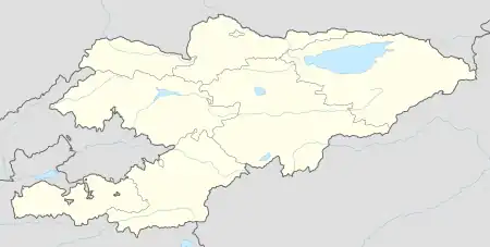 Kök-Janggak Location in Kyrgyzstan | |
| Coordinates: 41°02′N 73°12′E / 41.033°N 73.200°E | |
| Country | |
| Region | Jalal-Abad Region |
| District | Suzak District |
| Established | 1943 |
| Area | |
| • Total | 12.13 km2 (4.68 sq mi) |
| Highest elevation | 1,450 m (4,760 ft) |
| Lowest elevation | 1,200 m (3,900 ft) |
| Population (2021)[2] | |
| • Total | 12,117 |
Kök-Janggak (Kyrgyz: Көк-жаңгак, meaning "blue walnut" in Kyrgyz and Uzbek, Russian: Кок-Янгак Kok-Yangak)[3] is a city in Jalal-Abad Region in western Kyrgyzstan, located at a distance of about 29 km from the regional centre city Jalal-Abad. Its population was 12,117 in 2021.[2] It is a city of regional significance within the Suzak District.[4]
History
Kök-Janggak originated as a coal-mining settlement in 1910. The upper strata of coal of the Kok-Yangak coal deposit were mined on a small scale until the October Revolution. During the Civil War in Russia the mine was destroyed by basmachi and extraction was suspended. During the first five-year plan new drift mines were developed and an access railroad from Jalal-Abad was built in 1931, resulting in a rapid increase in coal production. In 1943 Kök-Janggak became a town.[3][5]
Population
The population of Kök-Janggak was 10,341 in 2004; including 8,400 - Kyrgyz, 640 - Uzbek, 540 - Russian, 210 - Tatar, 140 - Kazakh, and 411 - other nationalities.
| Year | Pop. | ±% p.a. |
|---|---|---|
| 1970 | 16,268 | — |
| 1979 | 17,281 | +0.67% |
| 1989 | 18,837 | +0.87% |
| 1999 | 10,727 | −5.48% |
| 2009 | 10,451 | −0.26% |
| 2021 | 12,117 | +1.24% |
| Note: resident population; Sources:[6][2] | ||
References
- ↑ "Webpage of Kökjanggak at website of Association of Cities of KR". Archived from the original on 2012-03-22. Retrieved 2010-02-16.
- 1 2 3 "Population of regions, districts, towns, urban-type settlements, rural communities and villages of Kyrgyz Republic" (XLS) (in Russian). National Statistics Committee of the Kyrgyz Republic. 2021. Archived from the original on 10 November 2021.
- 1 2 Кок-Янгак in the Great Soviet Encyclopedia, 1969–1978 (in Russian)
- ↑ "Classification system of territorial units of the Kyrgyz Republic" (in Kyrgyz). National Statistics Committee of the Kyrgyz Republic. May 2021. p. 24.
- ↑ Киргизская ССР [Kyrgyz SSR] (in Russian). Gos. izdatel'stvo geograficheskoi literatury. 1956.
- ↑ "2009 population and housing census of the Kyrgyz Republic: Jalal-Abad Region" (PDF) (in Russian). National Statistics Committee of the Kyrgyz Republic. 2010. p. 303.
External links