Kantabania
Kantabania Shasan Abhyanarendrapur Shasan | |
|---|---|
Village | |
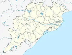
 Kantabania Location in Orissa, India  Kantabania Kantabania (India) | |
| Coordinates: 20°04′06″N 85°06′51″E / 20.068275°N 85.114077°E | |
| Country | |
| State | Orissa |
| District | Nayagarh |
| Area | |
| • Total | 0.62 km2 (0.24 sq mi) |
| Population | |
| • Total | 494 |
| • Density | 796/km2 (2,060/sq mi) |
| Languages | |
| • Official | Oriya |
| Time zone | UTC+5:30 (IST) |
| Vehicle registration | OD-25 |
| Nearest city | Nayagarh |
| Sex ratio | 1:1 ♂/♀ |
| Literacy | 98% |
| Lok Sabha constituency | puri |
| Website | https://www.kantabaniashasan.com |
| A Heavenly Place | |
Kantabania Sasana is a village under the Nayagarh district, Odisha, India. The village is only 9 km from the district headquarters, It is flawlessly connected by road to Nayagarh and other nearby towns and villages. Kantabanian are well educated and talented. Agriculture, Teaching, Puja and Rituals were the main profession of Kantabanian in 1980s and 1990s. Now Many Kantabanian are settled in state capital Bhubaneswar. Young kantabanian are working across the globe.
References
External links
This article is issued from Wikipedia. The text is licensed under Creative Commons - Attribution - Sharealike. Additional terms may apply for the media files.