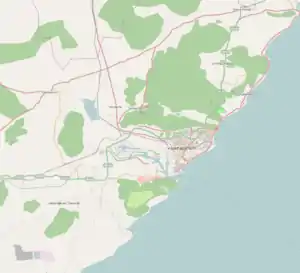
Kapuluppada | |
|---|---|
Neighbourhood | |
 Ramanaidu studio at Kapuluppada | |
 Kapuluppada Location in Visakhapatnam | |
| Coordinates: 17°49′42″N 83°23′08″E / 17.828371°N 83.385569°E | |
| Country | |
| State | Andhra Pradesh |
| District | Visakhapatnam |
| Government | |
| • Body | Greater Visakhapatnam Municipal Corporation |
| Languages | |
| • Official | Telugu |
| Time zone | UTC+5:30 (IST) |
| PIN | 530048 |
| Vehicle registration | AP-31 |
Kapuluppada is a neighborhood situated on the northern part of Visakhapatnam City, India. The area, which falls under the local administrative limits of Greater Visakhapatnam Municipal Corporation, is about 25 km from the Visakhapatnam Railway Station.[1]
About
Kapuluppada is one of the future Andhra Pradesh State Information Technology centers that the government of Andhra Pradesh is planning to set up many software companies there.[2]
Transport
- APSRTC routes
| Route Number | Start | End | Via |
|---|---|---|---|
| 900K | Railway Station | Bheemili | RTC Complex, Siripuram, Pedawaltair, Appughar, Sagarnagar, Rushikonda, Thimmapuram, INS Kalinga |
| 900T | Railway Station | Tagarapuvalasa | RTC Complex, Siripuram, Pedawaltair, Appughar, Sagarnagar, Rushikonda, Thimmapuram, INS Kalinga |
| 999 | RTC Complex | Bheemili | Maddilapalem, Hanumanthwaka, Yendada, Madhurawada, Anandapuram |
| 17K | Old Head Post Office | Bheemili | Town Kotharoad, Jagadamba Centre, RTC Complex, Siripuram, Pedawaltair, Appughar, Sagarnagar, Rushikonda, Thimmapuram, INS Kalinga |
See also
References
- ↑ "location". deccan chronicle. 25 August 2017. Retrieved 22 September 2017.
- ↑ "about". the hindu. 12 September 2017. Retrieved 21 September 2017.
This article is issued from Wikipedia. The text is licensed under Creative Commons - Attribution - Sharealike. Additional terms may apply for the media files.