Kargı District | |
|---|---|
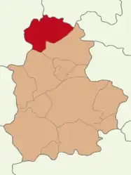 Map showing Kargı District in Çorum Province | |
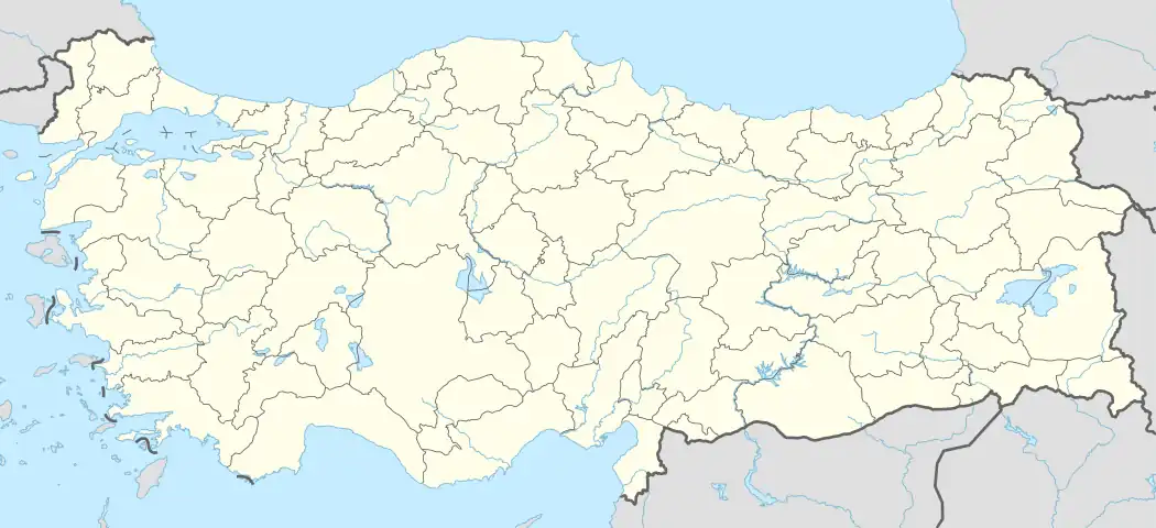 Kargı District Location in Turkey | |
| Coordinates: 41°08′N 34°29′E / 41.133°N 34.483°E | |
| Country | Turkey |
| Province | Çorum |
| Seat | Kargı |
| Area | 1,174 km2 (453 sq mi) |
| Population (2022) | 15,464 |
| • Density | 13/km2 (34/sq mi) |
| Time zone | TRT (UTC+3) |
| Website | www |
Kargı District is a district of the Çorum Province of Turkey. Its seat is the town of Kargı.[1] Its area is 1,174 km2,[2] and its population is 15,464 (2022).[3]
Composition
There is one municipality in Kargı District:[1]
There are 58 villages in Kargı District:[4]
- Abdullah
- Akçataş
- Akkaya
- Akkise
- Alioğlu
- Arık
- Avşar
- Bademce
- Bağözü
- Başköy
- Bayat
- Beygircioğlu
- Bozarmut
- Çakırlar
- Çalköy
- Çeltiközü
- Çetmi
- Cihadiye
- Çobankaya
- Çobanlar
- Çukuralıç
- Demirören
- Dereköy
- Gökbudak
- Gökçedoğan
- Gölet
- Göletdere
- Gölköy
- Gümüşoğlu
- Güneyköy
- Günyazı
- Hacıhamza
- Hacıveli
- Halılar
- İnceçay
- Kabakçı
- Karaboya
- Karacaoğlan
- Karakese
- Karaosmanlı
- Karapürçek
- Kavakçayı
- Köprübaşı
- Koyunkıran
- Maksutlu
- Oğuzköy
- Örencik
- Pelitçik
- Pelitözü
- Saraçlar
- Saraycık
- Sekiköy
- Sinanözü
- Sünlük
- Tepelice
- Uzunyurt
- Yağcılar
- Yeşilköy
References
- 1 2 İlçe Belediyesi, Turkey Civil Administration Departments Inventory. Retrieved 1 March 2023.
- ↑ "İl ve İlçe Yüz ölçümleri". General Directorate of Mapping. Retrieved 1 March 2023.
- ↑ "Address-based population registration system (ADNKS) results dated 31 December 2022, Favorite Reports" (XLS). TÜİK. Retrieved 13 March 2023.
- ↑ Köy, Turkey Civil Administration Departments Inventory. Retrieved 1 March 2023.
Kargı District in Çorum Province of Turkey | |||||||||||||||||||||||||||
|---|---|---|---|---|---|---|---|---|---|---|---|---|---|---|---|---|---|---|---|---|---|---|---|---|---|---|---|
| Districts | 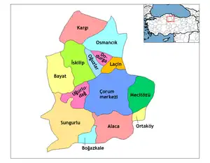 Districts of Çorum | ||||||||||||||||||||||||||
| |||||||||||||||||||||||||||
Metropolitan municipalities are bolded. | |||||||||||||||||||||||||||
This article is issued from Wikipedia. The text is licensed under Creative Commons - Attribution - Sharealike. Additional terms may apply for the media files.