Karmahari
Qasimpur | |
|---|---|
Village | |
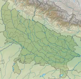
 Karmahari Location in Uttar Pradesh, India | |
| Coordinates: 25°21′00″N 83°38′31″E / 25.350°N 83.642°E | |
| Country | |
| State | Uttar Pradesh |
| District | Ghazipur |
| Established |
|
| Founded by | Zamindar Qasim Khan |
| Government | |
| • Type | Panchayati Raj (India) |
| • Body | Gram Pradhan |
| Area | |
| • Total | 472.34 ha (1,167.18 acres) |
| Elevation | 70 m (230 ft) |
| Population (2020) | |
| • Total | 5,544 |
| • Density | 1,200/km2 (3,000/sq mi) |
| Languages | |
| • Official | Bhojpuri, Hindi, Urdu |
| Time zone | UTC+5:30 (IST) |
| PIN | 232326 |
| Telephone code | 05497 |
| Vehicle registration | UP 61 |
Karmahari (also known as Qasimpur) is a village in Zamania Tehsil's Ghazipur district, Uttar Pradesh, India. Zamindar Qasim Khan established it in 1606. In 1763, most of Qasim Khan's family relocated to Daltonsganj and almost emptied the village. The family of Qasim Khan had 1542 Hectares of ancestral land, which they gave to other people and established Baraura, Karmahari, and Nonar village when they relocated to Daltonsganj. Later, some of his friends and family also relocated to Daltonsganj. The village is a part of Dewaitha Gram Panchayat.[1][2]
Demographics
| Year | Pop. | ±% |
|---|---|---|
| 1861 | 533 | — |
| 1871 | 597 | +12.0% |
| 1881 | 657 | +10.1% |
| 1891 | 736 | +12.0% |
| 1901 | 809 | +9.9% |
| 1911 | 890 | +10.0% |
| 1921 | 970 | +9.0% |
| 1931 | 1,020 | +5.2% |
| 1941 | 1,009 | −1.1% |
| 1951 | 1,110 | +10.0% |
| 1961 | 2,665 | +140.1% |
| 1971 | 2,980 | +11.8% |
| 1981 | 3,576 | +20.0% |
| 1991 | 3,933 | +10.0% |
| 2001 | 4,230 | +7.6% |
| 2011 | 4,535 | +7.2% |
| Source:Census of India[3][4][5] | ||
References
- ↑ ""Bhulekh"".
- ↑ ""2011 census of India"".
- ↑ "Census of India". mospi.gov.in. Archived from the original on 13 August 2008. Retrieved 23 June 2008.
- ↑ "2011 census of India".
- ↑ "Historical Census of India". Archived from the original on 17 February 2013. Retrieved 5 November 2015.
This article is issued from Wikipedia. The text is licensed under Creative Commons - Attribution - Sharealike. Additional terms may apply for the media files.