Karnal district | |
|---|---|
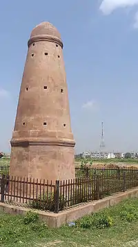
 Fort of Prithviraj Chauhan in Taraori | |
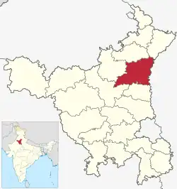 Location in Haryana | |
| Country | India |
| State | Haryana |
| Division | Karnal |
| Headquarters | Karnal |
| Tehsils | 1. Karnal, 2. Nilokheri, 3. Indri, 4. Gharaunda, 5. Assandh |
| Area | |
| • Total | 2,520 km2 (970 sq mi) |
| Population (2011) | |
| • Total | 1,505,324 |
| • Density | 600/km2 (1,500/sq mi) |
| • Urban | 26.51% |
| Demographics | |
| • Literacy | 74.73% |
| • Sex ratio | 887 |
| Time zone | UTC+05:30 (IST) |
| Lok Sabha constituencies | Karnal (shared with Panipat district) |
| Vidhan Sabha constituencies | 5 |
| Website | http://www.karnal.gov.in/ |
Karnal district is one of the 22 districts of Haryana, a state in North India which constitutes the National Capital Region (NCR) of the country. The city of Karnal is a part of the National Capital Region (NCR) and is the administrative headquarters of the district.
As it lies on National highway 44 (old NH-1), it has a well connected transport system to the nearby major cities like Delhi and Chandigarh. Karnal District is also well connected via railways. Karnal Junction lies on Delhi-Kalka line and major trains stops at this station. The district headquarter also has a small aerodrome known as karnal airport.
Sub-Divisions
The Karnal district is headed by an IAS officer of the rank of Deputy Commissioner (DC) who is the chief executive officer of the district. The district is divided into 4 sub-divisions, each headed by a Sub-Divisional Magistrate (SDM): Karnal, Indri, Assandh and Gharaunda.
Revenue tehsils
The above 4 sub-divisions are divided into 5 revenue tehsils, namely, Karnal, Indri, Nilokheri, Gharaunda & Assandh and 3 sub-tehsil namely Nigdhu, Nissing and Ballah.
Assembly constituencies
The Karnal district is divided into 5 Vidhan Sabha constituencies:
Karnal district is a part of Karnal (Lok Sabha constituency).
Demographics
| Year | Pop. | ±% p.a. |
|---|---|---|
| 1901 | 230,386 | — |
| 1911 | 208,536 | −0.99% |
| 1921 | 215,872 | +0.35% |
| 1931 | 221,887 | +0.28% |
| 1941 | 258,969 | +1.56% |
| 1951 | 353,764 | +3.17% |
| 1961 | 474,722 | +2.98% |
| 1971 | 619,533 | +2.70% |
| 1981 | 829,927 | +2.97% |
| 1991 | 1,035,390 | +2.24% |
| 2001 | 1,274,183 | +2.10% |
| 2011 | 1,505,324 | +1.68% |
| source:[1] | ||
According to the 2011 census Karnal district has a population of 1,505,324,[2] roughly equal to the nation of Gabon[3] or the US state of Hawaii.[4] This gives it a ranking of 333rd in India (out of a total of 640).[2] The district has a population density of 598 inhabitants per square kilometre (1,550/sq mi) .[2] Its population growth rate over the decade 2001-2011 was 18.22%.[2] Karnal has a sex ratio of 996 females for every 1,000 males,[2] and a literacy rate of 74.73%. Scheduled Castes made up 22.56% of the population.[2]
Religion
| Religion | Population (1941)[6]: 42 | Percentage (1941) | Population (2011)[5] | Percentage (2011) |
|---|---|---|---|---|
| Hinduism |
666,301 | 66.99% | 1,341,002 | 89.08% |
| Islam |
304,346 | 30.6% | 31,650 | 2.1% |
| Sikhism |
19,887 | 2% | 126,207 | 8.38% |
| Christianity |
1,223 | 0.12% | 2,049 | 0.14% |
| Others [lower-alpha 3] | 2,818 | 0.28% | 4,416 | 0.29% |
| Total Population | 994,575 | 100% | 1,505,324 | 100% |
Languages
At the time of the 2011 Census of India, 54.28% of the population in the district spoke Hindi, 32.04 Haryanvi, 10.86% Punjabi and 1.06% Multani as their first language.[7]
People from Karnal District
- Kalpana Chawla, First Indo-American woman astronaut. In 2003, Chawla was one of the seven crew members that died in the Space Shuttle Columbia disaster[8]
- Nawabzada Liaquat Ali Khan, First Prime Minister of Pakistan.
- Vikramjeet Virk, Indian actor.
- Navdeep Saini, Indian cricketer.
- Manohar Lal Khattar, Current Chief Minister of Haryana
- Kuldeep Sharma, Indian politician.
- Harwinder Kalyan, Indian politician.
- Karan Dev Kamboj, Indian politician.
- Dr. Shilpa, Public figure, social worker
Villages
See also
References
- ↑ Decadal Variation In Population Since 1901
- 1 2 3 4 5 6 "District Census 2011". Census2011.co.in. 2011. Retrieved 30 September 2011.
- ↑ US Directorate of Intelligence. "Country Comparison:Population". Archived from the original on 13 June 2007. Retrieved 1 October 2011.
Gabon 1,576,665
- ↑ "2010 Resident Population Data". U. S. Census Bureau. Archived from the original on 1 January 2011. Retrieved 30 September 2011.
Hawaii 1,360,301
- 1 2 "Table C-01 Population by Religion: Haryana". censusindia.gov.in. Registrar General and Census Commissioner of India.
- ↑ "CENSUS OF INDIA, 1941 VOLUME VI PUNJAB PROVINCE". Retrieved 20 July 2022.
- 1 2 "Table C-16 Population by Mother Tongue: Haryana". Census of India. Registrar General and Census Commissioner of India..
- ↑ "Only 98 cities instead of 100 announced: All questions answered about the smart cities project". 28 August 2015.
- ↑ Historic district borders may not be an exact match in the present-day due to various bifurcations to district borders — which since created new districts — throughout the historic Punjab Province region during the post-independence era that have taken into account population increases. This discrepancy can be seen in the district population history table which has taken into account the various bifurcations since 1941.
- ↑ 1941 census: Including Ad-Dharmis
- ↑ Including Jainism, Buddhism, Zoroastrianism, Judaism, or not stated
External links
Places adjacent to Karnal district | |
|---|---|