Kenora Airport | |||||||||||
|---|---|---|---|---|---|---|---|---|---|---|---|
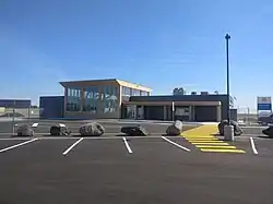
 McDougald International Terminal | |||||||||||
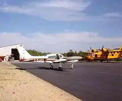
 Ministry of Natural Resources CL-125 and Cessna 310 at Kenora | |||||||||||
| Summary | |||||||||||
| Airport type | Public | ||||||||||
| Operator | Kenora Airport Authority Inc. | ||||||||||
| Location | Kenora, Ontario | ||||||||||
| Time zone | CST (UTC−06:00) | ||||||||||
| • Summer (DST) | CDT (UTC−05:00) | ||||||||||
| Elevation AMSL | 1,344 ft / 410 m | ||||||||||
| Coordinates | 49°47′18″N 094°21′47″W / 49.78833°N 94.36306°W | ||||||||||
| Website | Kenora Airport | ||||||||||
| Map | |||||||||||
 CYQK Location in Ontario  CYQK CYQK (Canada) | |||||||||||
| Runways | |||||||||||
| |||||||||||
| Statistics (2010) | |||||||||||
| |||||||||||
Kenora Airport (IATA: YQK, ICAO: CYQK) is located 5 nautical miles (9.3 km; 5.8 mi) east northeast of Kenora, Ontario, Canada. The airport is classified as an airport of entry by Nav Canada and is staffed by the Canada Border Services Agency (CBSA) on a call-out basis from the Fort Frances-International Falls International Bridge. CBSA officers at this airport can handle general aviation aircraft with no more than 15 passengers.[1] The airport has one asphalt runway that is 5,800 by 150 ft (1,768 by 46 m). The airport is under Aircraft Group Number (AGN) classification of IV.[4]
The airport was one of three finalists for the WestJet Innovation & Excellence Award for the Canadian Tourism Awards 2018, along with Vancouver International Airport and Quebec City Airport.[5]
Airlines and destinations
| Airlines | Destinations |
|---|---|
| Bearskin Airlines | Dryden, Fort Frances, Sioux Lookout, Thunder Bay, Winnipeg[6] |
See also
References
- 1 2 Canada Flight Supplement. Effective 0901Z 16 July 2020 to 0901Z 10 September 2020.
- ↑ Synoptic/Metstat Station Information Archived 2013-06-27 at the Wayback Machine
- ↑ Total aircraft movements by class of operation — NAV CANADA flight service stations
- ↑ Kenora Airport FAQ
- ↑ Stelter, Ryan (December 7, 2018). "Kenora Airport named a finalist at Canadian Tourism Awards". Kenora Miner & News. Retrieved October 23, 2021.
- ↑ AirportKenora.com
External links
- Past three hours METARs, SPECI and current TAFs for Kenora Airport from Nav Canada as available.