Tabsur (Khirbat 'Azzun)
(تبصر(خربة عزون Tabsar, Khirbet 'Azzun | |
|---|---|
Village | |
| Etymology: from personal name [1] | |
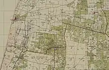
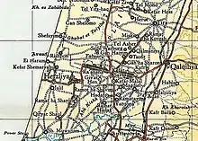
.jpg.webp) 1870s map 1870s map .jpg.webp) 1940s map 1940s map.jpg.webp) modern map modern map .jpg.webp) 1940s with modern overlay map 1940s with modern overlay mapA series of historical maps of the area around Tabsur (click the buttons) | |
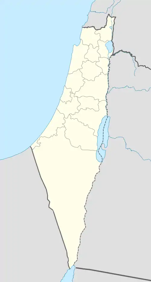
 Tabsur (Khirbat 'Azzun) Location within Mandatory Palestine | |
| Coordinates: 32°11′38″N 34°52′44″E / 32.19389°N 34.87889°E | |
| Palestine grid | 138/177 |
| Geopolitical entity | Mandatory Palestine |
| Subdistrict | Tulkarm |
| Date of depopulation | 3 April 1948[2] |
| Area | |
| • Total | 5,328 dunams (5.328 km2 or 2.057 sq mi) |
| Cause of evacuation | Expulsion by the Jewish Yishuv forces |
| Current Localities | Ra'anana[3] and Batzra[3] |
Tabsur (Arabic: تبصر), also Khirbat 'Azzun (Arabic: خربة عزون), was a Palestinian village located 19 kilometres southwest of Tulkarm. In 1931, the village had 218 houses and an elementary school for boys.[3] Its Palestinian population was expelled during the 1948 Arab-Israeli war.[4]
History
The site of Tabsur contained archaeological remains, including the foundations of a building, a well, fragments of mosaic pavement, and tombs.[3]
.In the 1860s, the Ottoman authorities granted 'Azzun an agricultural plot of land in the former confines of the Forest of Arsur (Ar. Al-Ghaba) in the coastal plain, west of the village.[5][6] Residents of 'Azzun then repopulated the archaeological site of Tabsur.[7]
In the late nineteenth century, Tabsur was described as a moderate-sized hamlet with a well to the north.[8] It was later classified as a hamlet by the Palestine Index Gazetteer.[7]
British Mandate era
During the British Mandate an elementary school for boys was established in the village. The village also had a few shops.[3]
In the 1922 census of Palestine there were 709 villagers; 700 Muslims and 9 Christians,[9] (where the Christians were all Orthodox,[10]) increasing in 1931 census to 994; 980 Muslims and 14 Christians, in 218 houses.[11]
In the 1944/45 statistics, a total of 1,602 dunums were allocated to cereals, while 24 dunums were irrigated or used for orchards.[12][13][14] 29 dunams were classified as built-up (urban) area.[15]


1948, aftermath
The Arabs of Tabsur were ordered to leave by the Haganah on 3 April 1948, as part of Haganas policy of clearing out the Arab villages on the coastal plain.[16] The villagers left on 16 April 1948.[16]
Ra'anana was established south of Tabsur in 1921. Now a city, some of its suburbs have expanded into land that once belonged to the village. Batzra, founded in 1946 on village land, lies to the north.[3]
In 1992, the Palestinian historian Walid Khalidi wrote: "The village has been completely covered with Israeli citrus orchards, making it difficult to distinguish from the surrounding lands. Citrus and cypress trees grow on the village land."[3]
The estimated number of Palestinian refugees from Tabsur in 1998 was 2,406.[4]
See also
References
- ↑ Palmer, 1881, p. 176
- ↑ Morris, 2004, p. xviii, village #192. Also gives cause of depopulation
- 1 2 3 4 5 6 7 Khalidi, 1992, p. 562
- 1 2 "Welcome to Tabsur". Palestine Remembered. Retrieved 2007-12-18.
- ↑ Marom, Roy, "The Contribution of Conder's Tent Work in Palestine for the Understanding of Shifting Geographical, Social and Legal Realities in the Sharon during the Late Ottoman Period", in Gurevich D. and Kidron, A. (eds.), Exploring the Holy Land: 150 Years of the Palestine Exploration Fund, Sheffield, UK, Equinox (2019), pp. 212-231
- ↑ Marom, Roy (2022). "The Oak Forest of the Sharon (al-Ghaba) in the Ottoman Period: New Insights from Historical- Geographical Studies, Muse 5". escholarship.org. Retrieved 2023-10-06.
- 1 2 Khalidi, 1992, p. 561
- ↑ Conder and Kitchener, 1882, SWP II, p. 135. Quoted in Khalidi, 1992, p. 561
- ↑ Listed under the Azzun-name. Barron, 1923, Table IX, Sub-district of Tulkarem, p. 28
- ↑ Listed under the Azzun-name. Barron, 1923, Table V, p. 48
- ↑ Mills, 1932, p. 53
- ↑ Department of Statistics, 1945, p. 21
- ↑ Government of Palestine, Department of Statistics. Village Statistics, April, 1945. Quoted in Hadawi, 1970, p. 76
- ↑ Government of Palestine, Department of Statistics. Village Statistics, April, 1945. Quoted in Hadawi, 1970, p. 127
- ↑ Government of Palestine, Department of Statistics. Village Statistics, April, 1945. Quoted in Hadawi, 1970, p. 177
- 1 2 Morris, 2004, p. 245
Bibliography
- Barron, J. B., ed. (1923). Palestine: Report and General Abstracts of the Census of 1922. Government of Palestine.
- Conder, C.R.; Kitchener, H.H. (1882). The Survey of Western Palestine: Memoirs of the Topography, Orography, Hydrography, and Archaeology. Vol. 2. London: Committee of the Palestine Exploration Fund.
- Department of Statistics (1945). Village Statistics, April, 1945. Government of Palestine.
- Hadawi, S. (1970). Village Statistics of 1945: A Classification of Land and Area ownership in Palestine. Palestine Liberation Organization Research Center.
- Khalidi, W. (1992). All That Remains: The Palestinian Villages Occupied and Depopulated by Israel in 1948. Washington D.C.: Institute for Palestine Studies. ISBN 0-88728-224-5.
- Mills, E., ed. (1932). Census of Palestine 1931. Population of Villages, Towns and Administrative Areas. Jerusalem: Government of Palestine.
- Morris, B. (2004). The Birth of the Palestinian Refugee Problem Revisited. Cambridge University Press. ISBN 978-0-521-00967-6.
- Palmer, E.H. (1881). The Survey of Western Palestine: Arabic and English Name Lists Collected During the Survey by Lieutenants Conder and Kitchener, R. E. Transliterated and Explained by E.H. Palmer. Committee of the Palestine Exploration Fund.
External links
- Welcome To Tabsur
- Tabsur (Khirbet 'Azzun), Zochrot
- Survey of Western Palestine, Map 10: IAA, Wikimedia commons