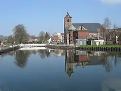
La Louvière
| |
|---|---|
 Houdeng-Aimeries | |
 Flag  Coat of arms | |
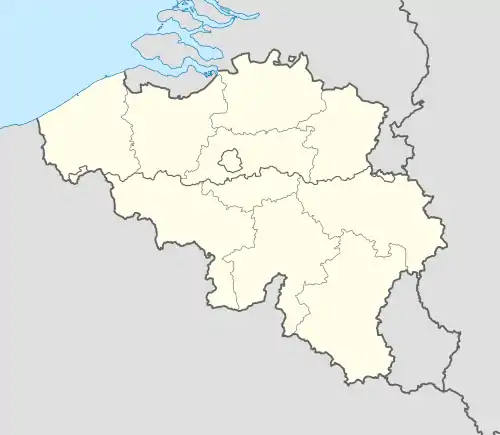
Location of La Louvière | |
 La Louvière Location in Belgium
Location of La Louvière in Hainaut  | |
| Coordinates: 50°28′N 04°11′E / 50.467°N 4.183°E | |
| Country | |
| Community | French Community |
| Region | Wallonia |
| Province | Hainaut |
| Arrondissement | La Louvière |
| Government | |
| • Mayor | Jacques Gobert (PS) |
| • Governing party/ies | PS, MR, UDSC |
| Area | |
| • Total | 64.56 km2 (24.93 sq mi) |
| Population (2019-09-01)[1] | |
| • Total | 80,986 |
| • Density | 1,300/km2 (3,200/sq mi) |
| Postal codes | 7100, 7110 |
| NIS code | 58001 |
| Area codes | 064 |
| Website | www.lalouviere.be |
La Louvière (French pronunciation: [la luvjɛʁ] ⓘ; Walloon: El Lovire) is a city and municipality of Wallonia located in the province of Hainaut, Belgium.
The municipality consists of the following districts: Boussoit, Haine-Saint-Paul, Haine-Saint-Pierre, Houdeng-Aimeries, Houdeng-Gœgnies, La Louvière, Maurage, Saint-Vaast, Strépy-Bracquegnies, and Trivières.
La Louvière is the capital of the Centre region, a former coal mining area in the Sillon industriel, between the Borinage to the West and the Pays Noir to the East.
History
Mythical origins
The legend of a mother wolf nursing a child at La Louvière is reminiscent of the mythical birth of Rome. The true origin of the city, however, dates from the 12th century. At that time, the forested, and presumably wolf-infested, territory of today’s La Louvière was named Menaulu, from the Old French meaning “wolf’s lair”. This land was part of the larger community of Saint-Vaast, which itself belonged to the Aulne Abbey.
By 1284, the name of the territory had been translated into Latin, then back into French to its current name of La Louvière. The lords of Saint-Vaast encouraged prospecting on their land, which led to the first extraction of coal in the year 1390. The abbey’s refusal to provide necessary infrastructure, however, delayed large-scale development until the 18th century.
Birth of La Louvière
In the 19th century, the construction of roads, canals, and railways finally allowed the local coal production to be exported. Investments also poured into the local industry to take advantage of the abundant source of energy. La Louvière quickly surpassed its overlord Saint-Vaast, both in population and economic wealth. Within fifty years, the territory that was not much more than a place name had become one of the most important cities in Wallonia. La Louvière was recognized as an independent city in 1869. Today, La Louvière is still the fifth largest city in Wallonia, after Charleroi, Liège, Namur, and Mons.
Sights


- There are four hydraulic boat lifts on the old Canal du Centre, which connects the river Meuse to the Scheldt. These double elevators date from around 1900 and were designated by UNESCO as a World Heritage Site in 1998.
- The housing complex that was built for the Bois-du-Luc coal workers during the first half of the 19th century has been restored. This is part of the Major Mining Sites of Wallonia, designated by UNESCO as a World Heritage Site in 2012. One of those houses can be visited, together with a couple of museums retracing the history of the coal mining industry in the Centre region.
- La Louvière counts a number of chapels and churches that date from the 13th to the 16th century.
- La Louvière also has one of the best collection of Idel Ianchelevici’s works on display.
Climate
La Louvière has an oceanic climate typical of Belgium with moderated seasons even for its inland position at 50° latitude, as a result of Gulf Stream influence.
| Climate data for La Louvière (1981–2010 normals, sunshine 1984–2013) | |||||||||||||
|---|---|---|---|---|---|---|---|---|---|---|---|---|---|
| Month | Jan | Feb | Mar | Apr | May | Jun | Jul | Aug | Sep | Oct | Nov | Dec | Year |
| Mean daily maximum °C (°F) | 5.5 (41.9) |
6.5 (43.7) |
10.2 (50.4) |
14.0 (57.2) |
18.1 (64.6) |
20.7 (69.3) |
23.2 (73.8) |
22.9 (73.2) |
19.2 (66.6) |
14.8 (58.6) |
9.5 (49.1) |
6.0 (42.8) |
14.2 (57.6) |
| Daily mean °C (°F) | 2.9 (37.2) |
3.3 (37.9) |
6.3 (43.3) |
9.1 (48.4) |
13.1 (55.6) |
15.8 (60.4) |
18.1 (64.6) |
17.7 (63.9) |
14.6 (58.3) |
10.9 (51.6) |
6.5 (43.7) |
3.5 (38.3) |
10.1 (50.2) |
| Mean daily minimum °C (°F) | 0.3 (32.5) |
0.1 (32.2) |
2.5 (36.5) |
4.3 (39.7) |
8.2 (46.8) |
11.0 (51.8) |
13.0 (55.4) |
12.6 (54.7) |
10.0 (50.0) |
7.1 (44.8) |
3.5 (38.3) |
1.2 (34.2) |
6.2 (43.2) |
| Average precipitation mm (inches) | 76.8 (3.02) |
63.5 (2.50) |
74.6 (2.94) |
53.5 (2.11) |
72.7 (2.86) |
78.6 (3.09) |
76.3 (3.00) |
80.0 (3.15) |
65.0 (2.56) |
76.7 (3.02) |
77.4 (3.05) |
80.9 (3.19) |
876.0 (34.49) |
| Average precipitation days | 13.2 | 11.4 | 13.4 | 10.4 | 11.9 | 11.4 | 10.5 | 10.7 | 10.9 | 11.4 | 13.4 | 13.4 | 142.1 |
| Mean monthly sunshine hours | 53 | 73 | 118 | 169 | 200 | 194 | 212 | 202 | 145 | 115 | 64 | 44 | 1,588 |
| Source: Royal Meteorological Institute[2] | |||||||||||||
Folklore
The Carnival of La Louvière is called Laetare, after the Latin verb meaning “to enjoy” (the introit at mass on the fourth Sunday of Lent begins Laetare Jerusalem, Rejoice Jerusalem). It lasts three days, Sunday to Tuesday, and takes place in the middle of Lent. The Gilles are out on all three days, stomping to the rhythm of their music and distributing oranges to the passers-by. Giant puppets and various other groups also take part in the parades and festivities. Typical of La Louvière’s celebrations is the so-called Brûlage des Bosses (“burning of the humps”), where a puppet dressed as a Gilles is burnt to symbolize the end of carnival and beginning of a new life.
Sports
La Louvière used to have a top level football club in Belgian First Division: RAA Louviéroise. They won the Belgian Cup in 2003. the club no longer exists as it merged into a team based in another city and its La Louvière playground is now the home of third division semi-amateur club UR La Louvière Centre.
Famous inhabitants
- Maurice Baudoux, (1902-1988), Canadian priest and Archbishop
- Anna Boch, (1848-1936), impressionist painter and art collector

- Eugène Boch, (1855-1941), impressionist painter, art collector, friend of Vincent van Gogh
- Pol Bury, sculptor (1922–2005)
- Jey Crisfar, actor (born 1988)
- Clement Desalle, Motocross racer (born 1989)
- Franco Dragone, theatre director (born 1952)
- Maurice Grevisse, grammarian (1895–1980)
- Eden Hazard, footballer (born 1991)
- Thorgan Hazard, footballer (born 1993)
- Kylian Hazard, footballer (born 1995)
- Jean Louvet, playwright (1934–2015)
- Enzo Scifo, footballer (born 1966)
- Charline Vanhoenacker, journalist (born 1977)
Twin cities
References
- ↑ Error: Unable to display the reference properly. See the documentation for details.
- ↑ "Klimaatstatistieken van de Belgische gemeenten" (PDF) (in Dutch). Royal Meteorological Institute. Retrieved 29 May 2018.
- ↑ "Kalisz Official Website - Twin Towns".

 (in English and Polish) © 2005-2008 Urząd Miejski Kalisz. Archived from the original on 2011-09-25. Retrieved 2008-11-29.
 - ↑ "İki Yeni Kardeş Şehir". Municipality Council Meeting. Giresun Municipality. 2016. Archived from the original on 8 January 2019. Retrieved 1 July 2016.
External links
- Official website of La Louvière, in French
- Site of the Centre region, in French
- Photographs of the Duferco steel mill
- The carnival, in French, Dutch, and English

