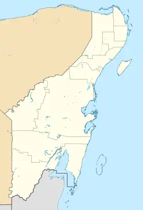
La Unión | |
|---|---|
 La Unión | |
| Coordinates: 17°53′50″N 88°52′50″W / 17.89722°N 88.88056°W | |
| Country | Mexico |
| State | Quintana Roo |
| Municipality | Othón P. Blanco |
| Elevation | 13 m (43 ft) |
| Population (2020) | 1,104 |
| [1] | |
| Time zone | UTC-5 (Eastern Time Zone) |
| Postal code | 77992 |
| Area code | 983 |
La Unión is a pueblo (village) located in the municipality of Othón P. Blanco in the state of Quintana Roo, Mexico.
Geography
La Unión is located on the left bank of the Hondo River, geographically located between 17º53'50 "N and 88º52'50" W, at about 13 meters above sea level. The village has a border port that connects with neighboring Blue Creek Village, Belize. There is an international bridge that connects both localities.[2]
References
- ↑ "Ubicación de La Unión". PueblosAmerica. Retrieved 18 December 2021.
- ↑ "Construcción de puente pone en peligro economía familiar". Novedades Quintana Roo. Retrieved 18 December 2021.
This article is issued from Wikipedia. The text is licensed under Creative Commons - Attribution - Sharealike. Additional terms may apply for the media files.