| Laugarvatn | |
|---|---|
 | |
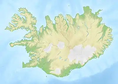 Laugarvatn | |
| Location | Iceland |
| Coordinates | 64°12′40″N 20°42′40″W / 64.21111°N 20.71111°W |
| Basin countries | Iceland |
| Surface area | 2.14 km2 (0.83 sq mi) |
| Settlements | Bláskógabyggð |

Landscape nearby the town.
Laugarvatn (Icelandic pronunciation: [ˈlœiːɣarˌvahtn̥] ⓘ) is the name of a lake and a small town in the south of Iceland. The lake is smaller than the neighbouring Apavatn.
Tourism
Laugarvatn lies within the Golden Circle, a popular tourist route, and acts as a staging post. The town has a population of about 200,[1] and lies predominantly along the west side of the lake. The lake contains geothermal springs under its surface, making it a popular swimming spot with some warm patches along the shoreline year-round.
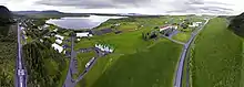
Aerial panorama of Laugarvatn, taken in June 2017
Education
Menntaskólinn að Laugarvatni (ML), a boarding gymnasium with approximately 200 students, is located in the town. Iceland University of Education's division of Sport and Physical Education was also located here.
See also
References
- ↑ Parnell, Fran; Presser, Brandon (2010-09-01). Lonely Planet Iceland. Lonely Planet. pp. 125–. ISBN 9781742203461. Retrieved 21 April 2014.
External links
- http://www.nat.is/travelguideeng/laugarvatn.htm (Information)
- Laugarvatn
This article is issued from Wikipedia. The text is licensed under Creative Commons - Attribution - Sharealike. Additional terms may apply for the media files.