Leudelange
Leideleng | |
|---|---|
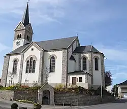 The church of Leudelange | |
 Coat of arms | |
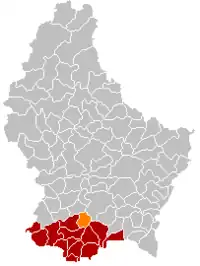 Map of Luxembourg with Leudelange highlighted in orange, and the canton in dark red | |
| Coordinates: 49°34′00″N 6°04′00″E / 49.5667°N 6.0667°E | |
| Country | |
| Canton | Esch-sur-Alzette |
| Area | |
| • Total | 13.57 km2 (5.24 sq mi) |
| • Rank | 84th of 102 |
| Highest elevation | 359 m (1,178 ft) |
| • Rank | 77th of 102 |
| Lowest elevation | 276 m (906 ft) |
| • Rank | 77th of 102 |
| Population (2023) | |
| • Total | 2,766 |
| • Rank | 58th of 102 |
| • Density | 200/km2 (530/sq mi) |
| • Rank | 40th of 102 |
| Time zone | UTC+1 (CET) |
| • Summer (DST) | UTC+2 (CEST) |
| LAU 2 | LU0000207 |
| Website | leudelange.lu |
Leudelange (French pronunciation: [lødlɑ̃ʒ]; Luxembourgish: Leideleng; German: Leudelingen) is a commune and town in south-western Luxembourg. It is situated in the canton of Esch-sur-Alzette.
As of 2007, the town of Leudelange, which lies in the centre of the commune, had a population of 2,100.
Leudelange was formed on 1 July 1856, when it was detached from the commune of Reckange-sur-Mess. The law forming Leudelange was passed on the 3 March 1856.[1]
Population
Notable people
- Norbert Sinner (1907–1945); a Luxembourgian cyclist, competed at the 1928 Summer Olympics; executed for Nazi collaboration
- Gilles Müller (born 1983), professional tennis player
References
- ↑ (in French and German) "Mémorial A, 1856, No. 7" (PDF). Service central de législation. Retrieved 2006-08-15.
- ↑ "Population par canton et commune". statistiques.public.lu. Archived from the original on 12 September 2016. Retrieved 11 January 2022.
External links
- Eco Habitat Lux: Solar pannel installation, Leudelange
 Media related to Leudelange at Wikimedia Commons
Places adjacent to Leudelange | |
|---|---|
 | ||
This article is issued from Wikipedia. The text is licensed under Creative Commons - Attribution - Sharealike. Additional terms may apply for the media files.