Liberty Township | |
|---|---|
 Location in Geary County | |
| Coordinates: 38°54′50″N 096°36′11″W / 38.91389°N 96.60306°W | |
| Country | United States |
| State | Kansas |
| County | Geary |
| Area | |
| • Total | 65.87 sq mi (170.61 km2) |
| • Land | 65.85 sq mi (170.56 km2) |
| • Water | 0.02 sq mi (0.05 km2) 0.03% |
| Elevation | 1,342 ft (409 m) |
| Population (2000) | |
| • Total | 225 |
| • Density | 3.4/sq mi (1.3/km2) |
| GNIS feature ID | 0476723 |
Liberty Township is a township in Geary County, Kansas, USA. As of the 2000 census, its population was 225.
History
Liberty Township was organized in 1875.[1]
Geography
Liberty Township covers an area of 65.87 square miles (170.6 km2) and contains no incorporated settlements. According to the USGS, it contains five cemeteries: Moss Springs, Olson, Quaker, Upper Humboldt and Welcome.
The streams of East Branch Humboldt Creek, West Branch Davis Creek, West Branch Dry Creek and West Branch Humboldt Creek run through this township.
References
- ↑ "Geary County History (archived)". Geary County Historical Society. Archived from the original on October 12, 2013. Retrieved June 10, 2014.
Further reading
External links
Municipalities and communities of Geary County, Kansas, United States | ||
|---|---|---|
| Cities | 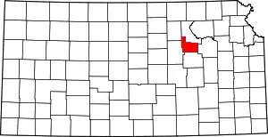 Map of Kansas highlighting Geary County | |
| Unincorporated communities | ||
| Ghost towns | ||
| Townships | ||
| Footnotes | †This community is designated a Census-Designated Place (CDP) by the United States Census Bureau. ‡This community also has portions in an adjacent county or counties. | |
This article is issued from Wikipedia. The text is licensed under Creative Commons - Attribution - Sharealike. Additional terms may apply for the media files.