Linzhou
林州市 | |
|---|---|
 Farms in Linzhou, Henan, irrigated by the Red Flag Canal | |
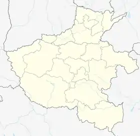
 Linzhou Location in Henan | |
| Coordinates: 36°01′09″N 113°51′36″E / 36.0193°N 113.8600°E | |
| Country | People's Republic of China |
| Province | Henan |
| Prefecture-level city | Anyang |
| Area | |
| • Total | 2,046 km2 (790 sq mi) |
| Population (2019)[2] | |
| • Total | 815,000 |
| Time zone | UTC+8 (China Standard) |
| Postal code | 456550 |
| Area code | (0)372 |
Linzhou (Chinese: 林州; pinyin: Línzhōu), formerly Lin County or Linxian (simplified Chinese: 林县; traditional Chinese: 林縣; pinyin: Lín Xiàn), is a county-level city in Anyang, Henan, China. Adjacent to Shanxi Province and Hebei Province, it is located in the north of Henan Province and at the eastern foot of the Taihang Mountains. It covers an area of 2046 square kilometers and has a population of about one million.[3]
Linzhou is well known for its Red Flag Canal, which was constructed in the 1960s.
Administrative divisions
As 2012, this city is divided to 4 subdistricts, 13 towns and 3 townships.[4]
- Subdistricts
|
|
- Towns
|
|
- Townships
- Chadian Township (茶店乡)
- Chengjiao Township (城郊乡)
- Shiban Township (石板岩乡)
Climate
| Climate data for Linzhou (1991–2015 normals, extremes 1981–2010) | |||||||||||||
|---|---|---|---|---|---|---|---|---|---|---|---|---|---|
| Month | Jan | Feb | Mar | Apr | May | Jun | Jul | Aug | Sep | Oct | Nov | Dec | Year |
| Record high °C (°F) | 18.7 (65.7) |
28.2 (82.8) |
32.6 (90.7) |
40.8 (105.4) |
39.6 (103.3) |
42.7 (108.9) |
41.4 (106.5) |
39.0 (102.2) |
40.6 (105.1) |
34.5 (94.1) |
28.5 (83.3) |
25.1 (77.2) |
42.7 (108.9) |
| Mean daily maximum °C (°F) | 5.0 (41.0) |
8.8 (47.8) |
14.8 (58.6) |
22.0 (71.6) |
27.5 (81.5) |
31.5 (88.7) |
31.4 (88.5) |
29.8 (85.6) |
26.0 (78.8) |
21.1 (70.0) |
13.4 (56.1) |
6.9 (44.4) |
19.9 (67.7) |
| Daily mean °C (°F) | −1.8 (28.8) |
2.1 (35.8) |
8.1 (46.6) |
15.3 (59.5) |
21.2 (70.2) |
25.6 (78.1) |
26.3 (79.3) |
24.6 (76.3) |
20.1 (68.2) |
14.5 (58.1) |
6.5 (43.7) |
0.2 (32.4) |
13.6 (56.4) |
| Mean daily minimum °C (°F) | −6.5 (20.3) |
−2.8 (27.0) |
2.4 (36.3) |
8.8 (47.8) |
14.7 (58.5) |
19.6 (67.3) |
21.8 (71.2) |
20.3 (68.5) |
15.1 (59.2) |
9.1 (48.4) |
1.5 (34.7) |
−4.3 (24.3) |
8.3 (47.0) |
| Record low °C (°F) | −21.5 (−6.7) |
−20.5 (−4.9) |
−8.8 (16.2) |
−4.4 (24.1) |
2.3 (36.1) |
9.1 (48.4) |
15.1 (59.2) |
11.0 (51.8) |
4.2 (39.6) |
−3.1 (26.4) |
−18.2 (−0.8) |
−16.5 (2.3) |
−21.5 (−6.7) |
| Average precipitation mm (inches) | 4.1 (0.16) |
8.7 (0.34) |
13.9 (0.55) |
32.5 (1.28) |
51.1 (2.01) |
68.8 (2.71) |
171.9 (6.77) |
147.2 (5.80) |
76.3 (3.00) |
27.8 (1.09) |
19.4 (0.76) |
4.4 (0.17) |
626.1 (24.64) |
| Average precipitation days (≥ 0.1 mm) | 2.6 | 3.3 | 4.0 | 5.6 | 7.3 | 9.0 | 13.6 | 12.4 | 9.4 | 5.6 | 4.2 | 2.2 | 79.2 |
| Average snowy days | 3.7 | 3.9 | 1.6 | 0.3 | 0 | 0 | 0 | 0 | 0 | 0 | 1.8 | 2.9 | 14.2 |
| Average relative humidity (%) | 61 | 58 | 54 | 55 | 57 | 58 | 74 | 78 | 74 | 66 | 66 | 63 | 64 |
| Mean monthly sunshine hours | 141.4 | 140.0 | 187.3 | 212.0 | 235.5 | 203.8 | 173.5 | 170.6 | 161.1 | 174.6 | 153.2 | 143.7 | 2,096.7 |
| Percent possible sunshine | 45 | 45 | 50 | 54 | 54 | 47 | 39 | 41 | 44 | 51 | 50 | 48 | 47 |
| Source: China Meteorological Administration[5][6] | |||||||||||||
See also
References
- ↑ 最新人口信息 www.hongheiku.com (in Chinese). hongheiku. Retrieved 2021-01-12.
- ↑ 最新人口信息 www.hongheiku.com (in Chinese). hongheiku. Retrieved 2021-01-12.
- ↑ Official website of Linzhou City
- ↑ 安阳市-行政区划网 www.xzqh.org (in Chinese). XZQH. Retrieved 2012-05-24.
- ↑ 中国气象数据网 – WeatherBk Data (in Simplified Chinese). China Meteorological Administration. Retrieved 12 August 2023.
- ↑ 中国气象数据网 (in Simplified Chinese). China Meteorological Administration. Retrieved 12 August 2023.
External links
This article is issued from Wikipedia. The text is licensed under Creative Commons - Attribution - Sharealike. Additional terms may apply for the media files.