| Disputed shoal | |
|---|---|
 Loaita Nan | |
| Geography | |
| Location | South China Sea |
| Coordinates | 10°42′1″N 114°19′1″E / 10.70028°N 114.31694°E |
| Archipelago | Spratly Islands |
| Administration | |
| Region | IV-B - MIMAROPA |
| Province | Palawan |
| Municipality | Kalayaan |
| Claimed by | |
| City | Sansha, Hainan |
| Municipality | Kalayaan, Palawan |
| Municipality District | Kaohsiung Cijin |
| District | Trường Sa, Khánh Hòa |
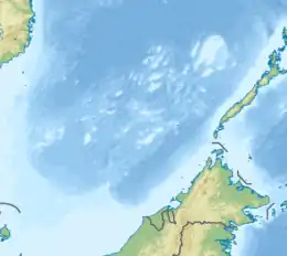
Loaita Nan (Mandarin Chinese: 双黄沙洲; pinyin: Shuāng Huáng Shāzhōu) is a shoal in the Loaita Bank of the Spratly Islands. Located at the southwest end of Daoming Reefs, it is composed of coral reefs. It is claimed by the government of China, Taiwan and the Philippines. Loaita Cay is northeast of Loaita Nan.
History
Chinese fishermen has described Loaita Nan as "double yellows".[2] In 1983, The Chinese government announced that the Chinese name of the shoal is Shuanghuang Shazhou.[3]
Environment
The sandbar looks like two egg yolks at low tide, hence its name. The length at high tide is 0.25 km (0.16 mi), the length of the reef is 2km, the width at high tide is 60m, the width of the Loaita Nan is 1.1 km (0.68 mi), the shallow water depth is 5.4–9 m (18–30 ft), and the central deep water is 20.1 m (66 ft).[4]
See also
References
- ↑ "Peace in the South China Sea, National Territory Secure Forever: Position Paper on ROC South Clina Sea Policy" (PDF). ROC Ministry of Foreign Affairs. 2016. Retrieved 28 December 2021.
- ↑ "双黄沙洲". www.unanhai.com. Archived from the original on 2018-07-12. Retrieved 2018-07-12.
- ↑ 广东地名委员会 (1987-03-01). 《南海诸岛地名资料汇编》. 广东地图出版社. p. 56. ISBN 9787805220239.
- ↑ 高俊国,刘宝银 (2009). 《南沙群岛空间融合信息分析与示警:群礁发育、军事区位、警示系统》. 海洋出版社. pp. 40–41. ISBN 9787502773083.