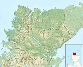
| Loch Cròcach | |
|---|---|
 Loch Crocach islands | |
 Loch Cròcach Location in Sutherland | |
| Location | NC10032720 |
| Coordinates | 58°11′41″N 5°13′42″W / 58.194749°N 5.228420°W |
| Type | freshwater loch |
| Max. length | 2.15 km (1.34 mi)[1] |
| Max. width | 1 km (0.62 mi)[1] |
| Surface area | 60 ha (150 acres)[2] |
| Average depth | 17 ft (5.2 m)[1] |
| Max. depth | 71 ft (22 m)[1] |
| Water volume | 108,519,039 cu ft (3,072,917.0 m3)[1] |
| Shore length1 | 12 km (7.5 mi) [2] |
| Surface elevation | 107 m (351 ft)[2] |
| Max. temperature | 53.7 °F (12.1 °C) |
| Min. temperature | 50.8 °F (10.4 °C) |
| Islands | 18 islands and many rocky islets |
| 1 Shore length is not a well-defined measure. | |
Loch Cròcach is a large irregular shaped, shallow loch, located about three miles north of Lochinver in the Assynt district of Sutherland, Highland, Scotland.[1][2] It is one of five lochs in Scotland with the same name. Loch Cròcach is located in an area known as the Assynt-Coigach National Scenic Area,[3] one of 40 such areas in Scotland.[4]
Hut circles
To the south and west of Loch Cròcach are the remains of several prehistoric Hut circles.[5]
References
- 1 2 3 4 5 6 John, Murray; Lawrence, Pullar. Bathymetrical Survey of the Fresh-Water Lochs of Scotland, 1897–1909 Lochs of the Tay Basin Volume II – Loch Cròcach. National Library of Scotland. p. 156. Retrieved 11 September 2021.
 This article incorporates text from this source, which is in the public domain.
 - 1 2 3 4 "Loch Cròcach". Centre for Ecology and Hydrology. Scotland and Northern Ireland Forum for Environmental Research (SNIFFER). Retrieved 11 September 2021.
- ↑ "Assynt-Coigach National Scenic Area". NatureScot. Retrieved 2 October 2020.
- ↑ "National Scenic Areas". NatureScot. Retrieved 2 November 2022.
- ↑ "Loch Cròcach Sites". Canmore. National Record of the Historic Environment. Retrieved 30 September 2021.
External links
This article is issued from Wikipedia. The text is licensed under Creative Commons - Attribution - Sharealike. Additional terms may apply for the media files.