Méry-sur-Seine | |
|---|---|
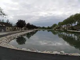 The Haute-Seine canal in Méry-sur-Seine | |
 Coat of arms | |
Location of Méry-sur-Seine | |
 Méry-sur-Seine 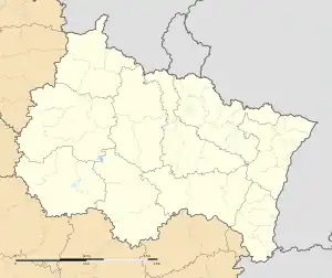 Méry-sur-Seine | |
| Coordinates: 48°30′41″N 3°53′25″E / 48.5114°N 3.8903°E | |
| Country | France |
| Region | Grand Est |
| Department | Aube |
| Arrondissement | Nogent-sur-Seine |
| Canton | Creney-près-Troyes |
| Government | |
| • Mayor (2020–2026) | Carmen Labille[1] |
| Area 1 | 12.42 km2 (4.80 sq mi) |
| Population | 1,465 |
| • Density | 120/km2 (310/sq mi) |
| Time zone | UTC+01:00 (CET) |
| • Summer (DST) | UTC+02:00 (CEST) |
| INSEE/Postal code | 10233 /10170 |
| Website | www |
| 1 French Land Register data, which excludes lakes, ponds, glaciers > 1 km2 (0.386 sq mi or 247 acres) and river estuaries. | |
Méry-sur-Seine (French pronunciation: [meʁi syʁ sɛn], literally Méry on Seine) is a commune in the Aube department in north-central France.
Population
| Year | Pop. | ±% p.a. |
|---|---|---|
| 1968 | 1,109 | — |
| 1975 | 1,174 | +0.82% |
| 1982 | 1,254 | +0.95% |
| 1990 | 1,302 | +0.47% |
| 1999 | 1,326 | +0.20% |
| 2007 | 1,380 | +0.50% |
| 2012 | 1,489 | +1.53% |
| 2017 | 1,526 | +0.49% |
| Source: INSEE[3] | ||
See also
References
- ↑ "Répertoire national des élus: les maires". data.gouv.fr, Plateforme ouverte des données publiques françaises (in French). 2 December 2020.
- ↑ "Populations légales 2021". The National Institute of Statistics and Economic Studies. 28 December 2023.
- ↑ Population en historique depuis 1968, INSEE
Wikimedia Commons has media related to Méry-sur-Seine.
This article is issued from Wikipedia. The text is licensed under Creative Commons - Attribution - Sharealike. Additional terms may apply for the media files.