Babolsar
Persian: بابلسر | |
|---|---|
City | |
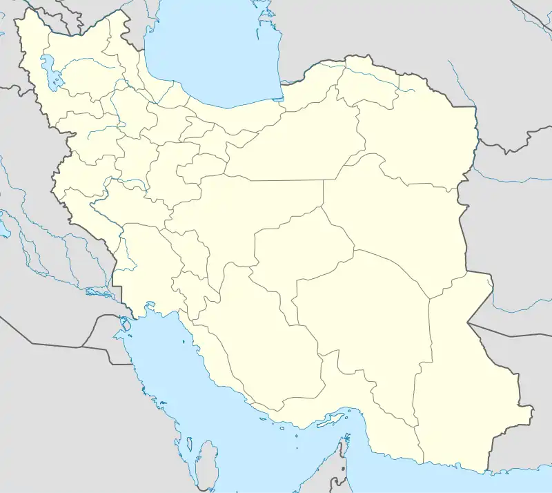 Babolsar | |
| Coordinates: 36°42′02″N 52°39′00″E / 36.70056°N 52.65000°E[1] | |
| Country | Iran |
| Province | Mazandaran |
| County | Babolsar |
| District | Central |
| Population (2016)[2] | |
| • Total | 59,966 |
| Time zone | UTC+3:30 (IRST) |
| Area code | 011 |
| Website | www |
Babolsar (Persian: بابلسر, also Romanized as Bābolsar and Bābul Sar; also known as Mashhadsar (Persian: مَشهَدسَر), also Romanized as Mashhad-i-Sar and Meshed-i-Sar)[3] is a city in, and the capital of, the Central District of Babolsar County, Mazandaran province, Iran, and also serves as capital of the county. It is along the Caspian Sea.
At the 2006 census, its population was 47,872 in 13,442 households.[4] The following census in 2011 counted 50,477 people in 15,583 households.[5] The latest census in 2016 showed a population of 59,966 people in 19,576 households.[2]
History
The city acquired its current name in 1927. The city's historic name is MaÞhad-e Sar or Mashhadsar, meaning "the special way to Mashhad, referring to the only road connecting the northwest of Iran to the northeast, including Mashhad, which passed through Babolsar. By the 18th century, Babolsar had become a busy commercial port. During the reign of Nadir Shah, it was the base for Iran's Caspian fleet. By 1909, the port yielded 12 percent of the total customs revenue of Iran. However, by 1895, ports in Gilan were already competing with Babolsar.
During Reza Shah's reign, Babolsar lost much of its remaining trade to the new port of Bandar-e Shah at the terminus of the trans-Iranian railroad. The cargo handled at Babolsar in the years of 1935 and 1936 was only 25,000 tons. A modern quarter and a hotel were built during this period. The end of World War II brought a new era of vitality to the city as a summer seaside resort for people from Iran, which gave rise to a new phase of rapid expansion. Babolsar's population increased from about 3,500 in 1946 to 11,781 in 1966 and 18,810 in 1976.
Geography
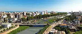
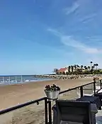
Babolsar is located on the southern coast of the Caspian Sea. Since the Babol river passes through the city, both the bank of the river and the beach of the sea form tourist attractions in the city. The city is home to the major faculties of the University of Mazandaran.
.jpg.webp)

Climate
Babolsar has a humid subtropical climate (Köppen: Cfa, Trewartha: Cf), with hot, steamy, but mostly dry summers and cool winters. Rainfall may occur at any time of the year but is heaviest in autumn and winter.
| Climate data for Babolsar | |||||||||||||
|---|---|---|---|---|---|---|---|---|---|---|---|---|---|
| Month | Jan | Feb | Mar | Apr | May | Jun | Jul | Aug | Sep | Oct | Nov | Dec | Year |
| Record high °C (°F) | 25.8 (78.4) |
24.6 (76.3) |
31.0 (87.8) |
32.4 (90.3) |
42.0 (107.6) |
36.0 (96.8) |
37.0 (98.6) |
39.0 (102.2) |
39.0 (102.2) |
34.0 (93.2) |
30.0 (86.0) |
25.0 (77.0) |
42.0 (107.6) |
| Daily mean °C (°F) | 8.0 (46.4) |
8.2 (46.8) |
10.3 (50.5) |
14.7 (58.5) |
19.8 (67.6) |
24.1 (75.4) |
26.4 (79.5) |
26.5 (79.7) |
23.8 (74.8) |
19.0 (66.2) |
13.9 (57.0) |
9.9 (49.8) |
17.1 (62.7) |
| Record low °C (°F) | −7 (19) |
−4 (25) |
−2 (28) |
1.0 (33.8) |
6.0 (42.8) |
9.0 (48.2) |
15.0 (59.0) |
16.0 (60.8) |
9.0 (48.2) |
4.0 (39.2) |
0.0 (32.0) |
−3 (27) |
−7 (19) |
| Average precipitation mm (inches) | 92.7 (3.65) |
67.5 (2.66) |
66.0 (2.60) |
32.7 (1.29) |
19.7 (0.78) |
22.5 (0.89) |
29.1 (1.15) |
48.9 (1.93) |
92.9 (3.66) |
149.0 (5.87) |
141.9 (5.59) |
126.4 (4.98) |
889.3 (35.05) |
| Average rainy days | 10.7 | 9.6 | 11.5 | 8.2 | 6.3 | 4.7 | 4.9 | 7.9 | 7.8 | 9.0 | 9.1 | 10.6 | 100.3 |
| Average snowy days | 0.7 | 0.9 | 0.3 | 0 | 0 | 0 | 0 | 0 | 0 | 0 | 0 | 0.2 | 2.1 |
| Average relative humidity (%) | 85 | 84 | 84 | 82 | 80 | 77 | 78 | 79 | 81 | 84 | 86 | 86 | 82 |
| Mean monthly sunshine hours | 124.7 | 119.4 | 126.5 | 162.0 | 214.2 | 242.4 | 237.9 | 205.0 | 181.5 | 161.4 | 136.9 | 122.4 | 2,034.3 |
| Source: NOAA (1961–1990) [6] | |||||||||||||
Tourist Attractions
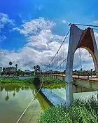
- Babolsar Suspended Bridge
- Babolsar Seaside
- Babol Roud
- University of Mazandaran Building
- Khazar Shahr
- Narjes School
- Imamzadeh Ibrahim
- Azizak Lagoon
- Mirud
- Babolsar Boating Pier
- Babolsar Cable Bridge
- Zoo Garden Shapoor Dashad
- Kar Fun
Residence
The city is popular because of its many hotels and villas as well as the Darya Kenar Town, located 5 kilometers outside Babolsar, were many Iranians vacation.
- Mizban Hotel
Education
Universities

University of Mazandaran (UMZ), currently the largest state higher education center in the province of Mazandaran, had formerly consisted of a number of tertiary education centers. In 1979 the centers were officially merged to form what is now known as University of Mazandaran. In recent years, UMZ has made significant progress, expanding itself with vision both qualitatively and quantitatively. It presently includes 12 faculties on its campus: Faculty of Mathematical Sciences, Faculty of Theology and Islamic Sciences, Faculty of Marine and Oceanic Sciences, Faculty of Basic Sciences, Faculty of Arts and Architecture, Faculty of Law and Political Sciences, Faculty of Physical Education and Sports Sciences, Faculty of Humanities and Social Sciences, Faculty of Economics and Administrative Sciences, Faculty of Chemistry, Faculty of Technology and Engineering, and Faculty of Cultural Heritage, Handicrafts and Tourism.
UMZ has now about 12,000 students who are currently studying at undergraduate, graduate, and post-graduate levels and over 400 faculty members teaching and researching at different faculties of the university.
Sister city
References
- ↑ OpenStreetMap contributors (23 May 2023). "Babolsar, Babolsar County" (Map). OpenStreetMap. Retrieved 23 May 2023.
- 1 2 "Census of the Islamic Republic of Iran, 1395 (2016)". AMAR (in Persian). The Statistical Center of Iran. p. 02. Archived from the original (Excel) on 7 October 2021. Retrieved 19 December 2022.
- ↑ Babolsar can be found at GEOnet Names Server, at this link, by opening the Advanced Search box, entering "-3054346" in the "Unique Feature Id" form, and clicking on "Search Database".
- ↑ "Census of the Islamic Republic of Iran, 1385 (2006)". AMAR (in Persian). The Statistical Center of Iran. p. 02. Archived from the original (Excel) on 20 September 2011. Retrieved 25 September 2022.
- ↑ "Census of the Islamic Republic of Iran, 1390 (2011)" (Excel). Iran Data Portal (in Persian). The Statistical Center of Iran. p. 02. Retrieved 19 December 2022.
- ↑ "Babolsar Climate Normals 1961-1990". National Oceanic and Atmospheric Administration. Retrieved 28 December 2012.
- Bābolsar entry in the Encyclopædia Iranica
