Matyldów | |
|---|---|
Village | |
 Matyldów | |
| Coordinates: 52°26′38″N 19°41′26″E / 52.44389°N 19.69056°E | |
| Country | |
| Voivodeship | Masovian |
| County | Płock |
| Gmina | Łąck |
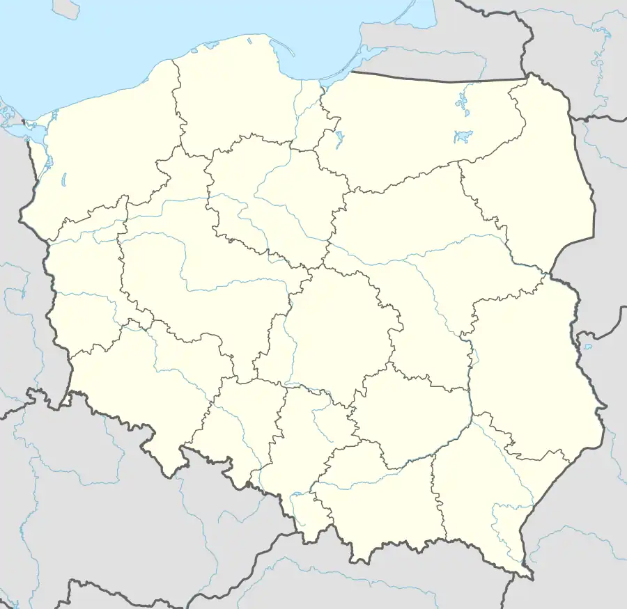
Matyldów [maˈtɨlduf] is a village in the administrative district of Gmina Łąck, within Płock County, Masovian Voivodeship, in east-central Poland.[1] It lies approximately 6 kilometres (4 mi) east of Łąck, 12 km (7 mi) south of Płock, and 93 km (58 mi) west of Warsaw. It lies on the shore of Zdworskie Lake.
References
| Seat |  | |
|---|---|---|
| Other villages | ||
This article is issued from Wikipedia. The text is licensed under Creative Commons - Attribution - Sharealike. Additional terms may apply for the media files.