Merlas | |
|---|---|
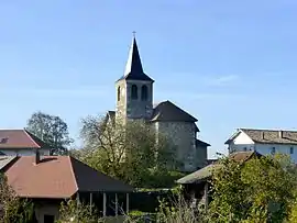 The church of Saint-Ferréol | |
Location of Merlas | |
 Merlas 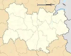 Merlas | |
| Coordinates: 45°26′44″N 5°39′48″E / 45.4456°N 5.6633°E | |
| Country | France |
| Region | Auvergne-Rhône-Alpes |
| Department | Isère |
| Arrondissement | La Tour-du-Pin |
| Canton | Chartreuse-Guiers |
| Intercommunality | CA Pays Voironnais |
| Government | |
| • Mayor (2020–2026) | Denis Grandperrin[1] |
| Area 1 | 15.64 km2 (6.04 sq mi) |
| Population | 469 |
| • Density | 30/km2 (78/sq mi) |
| Time zone | UTC+01:00 (CET) |
| • Summer (DST) | UTC+02:00 (CEST) |
| INSEE/Postal code | 38228 /38620 |
| Elevation | 400–925 m (1,312–3,035 ft) (avg. 600 m or 2,000 ft) |
| 1 French Land Register data, which excludes lakes, ponds, glaciers > 1 km2 (0.386 sq mi or 247 acres) and river estuaries. | |
Merlas (French pronunciation: [mɛʁla]) is a commune in the Isère department in southeastern France.[3]
Population

The ruins of the Saint-Sixte castle, in the town of Merlas
| Year | Pop. | ±% p.a. |
|---|---|---|
| 1968 | 373 | — |
| 1975 | 290 | −3.53% |
| 1982 | 320 | +1.42% |
| 1990 | 381 | +2.20% |
| 1999 | 405 | +0.68% |
| 2009 | 487 | +1.86% |
| 2014 | 498 | +0.45% |
| 2020 | 476 | −0.75% |
| Source: INSEE[4] | ||
See also
References
- ↑ "Répertoire national des élus: les maires" (in French). data.gouv.fr, Plateforme ouverte des données publiques françaises. 13 September 2022.
- ↑ "Populations légales 2021". The National Institute of Statistics and Economic Studies. 28 December 2023.
- ↑ INSEE commune file
- ↑ Population en historique depuis 1968, INSEE
Wikimedia Commons has media related to Merlas.
This article is issued from Wikipedia. The text is licensed under Creative Commons - Attribution - Sharealike. Additional terms may apply for the media files.