Missenyi District
Wilaya ya Missenyi | |
|---|---|
 Missenyi District of Kagera Region | |
| Coordinates: 1°07′56″S 31°26′17″E / 1.132222°S 31.438056°E | |
| Country | |
| Region | Kagera Region |
| Established | 2007 |
| Government | |
| • Type | Council |
| • Body | Missenyi District Council |
| • District Commissioner | Wilson Christian Sakulo |
| • District Secretary | Abdallah R. Mayomba |
| • Chairman of Council | Projestus Tegamaisho |
| Area | |
| • Total | 2,825 km2 (1,091 sq mi) |
| Elevation | 1,200 m (3,900 ft) |
| Population (2012) | |
| • Total | 202,632 |
| • Density | 72/km2 (190/sq mi) |
| Website | http://www.missenyidc.go.tz/ |
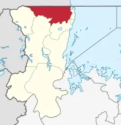
Missenyi District is one of the eight districts of the Kagera Region of Tanzania. The district was created in 2007, separating from Bukoba District. It is bordered to the north by Uganda, to the east by Bukoba Rural District, to the south by Karagwe District and to the west by Kyerwa District.[1][2]
According to the 2012 Tanzania National Census, the population of Missenyi District was 202,632, with a population density of 72 inhabitants per square kilometre (190/sq mi).[3][2]
Administrative subdivisions
As of 2012, Missenyi District was administratively divided into 20 wards with 77 villages.[4][3]
Wards
- Bugandika
- Bugorora
- Buyango
- Bwanjai
- Gera
- Ishozi
- Ishunju
- Kakunyu
- Kanyigo
- Kashenye
- Kassambya
- Kilimilile
- Kitobo
- Kyaka
- Mabale
- Minziro
- Mushasha
- Mutukula
- Nsunga
- Ruzinga
Transport
Paved trunk road T4 from Mwanza to the Ugandan border passes through Missenyi District. Unpaved trunk road T38 to Ngara District, through Karagwe District, branches off from T4 in the village of Kyaka.[5]
References
- ↑ "Historia" [History]. Ofisi ya Rais, Tawala za Mikoa na Serikali za mitaa (in Swahili). Bukoba, Tanzania: Halmashauri ya Wilaya ya Missenyi. Retrieved 2 July 2022.
- 1 2 "Kagera Region in Tanzania". City Population. Retrieved 2 July 2022.
- 1 2 "Tanzania National Census 2012". National Bureau of Statistics. Dodoma, Tanzania. March 2013. p. 164. Retrieved 1 July 2022.
- ↑ "Takwimu" [Statistics]. Ofisi ya Rais, Tawala za Mikoa na Serikali za mitaa (in Swahili). Bukoba, Tanzania: Halmashauri ya Wilaya ya Missenyi. Retrieved 2 July 2022.
- ↑ "Kagera Roads Network" (PDF). Tanroads. Archived from the original (PDF) on 23 February 2016. Retrieved 16 February 2016.