Mount Fletcher | |
|---|---|
| Tlokoeng | |
 Mount Fletcher  Mount Fletcher | |
| Coordinates: 30°41′31″S 28°30′11″E / 30.692°S 28.503°E | |
| Country | South Africa |
| Province | Eastern Cape |
| District | Joe Gqabi |
| Municipality | Elundini |
| Area | |
| • Total | 9.23 km2 (3.56 sq mi) |
| Population (2011)[1] | |
| • Total | 11,488 |
| • Density | 1,200/km2 (3,200/sq mi) |
| Racial makeup (2011) | |
| • Black African | 99.0% |
| • Coloured | 0.1% |
| • Indian/Asian | 0.3% |
| • Other | 0.5% |
| First languages (2011) | |
| • Hlubi | 70.5% |
| • Sotho | 32.2% |
| • Xhosa | 5.9% |
| • English | 1.8% |
| • Other | 3.6% |
| Time zone | UTC+2 (SAST) |
| PO box | 4770 |
| Area code | 039 |
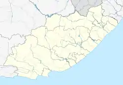
Mount Fletcher, officially Tlokoeng, is a town in Joe Gqabi District Municipality in the Eastern Cape province of South Africa, 69 km north-north-east of Maclear.
Founded in 1882, Mount Fletcher takes its name from the mountain nearby. This was probably named after the Reverend John Fletcher of Madeley in England, a friend of John Wesley, although it is stated to have been named after a Captain Fletcher who was stationed there.[2]
In 2022, the town was officially renamed Tlokoeng which "means place of the Tlokoa clan" in Sesotho. [3] The provincial hospital in Tlokoeng is named Tayler Bequest.[4]
References
- 1 2 3 4 "Main Place Mount Fletcher". Census 2011.
- ↑ "Dictionary of Southern African Place Names (Public Domain)". Human Science Research Council. p. 318.
- ↑ HALLEBACH, Peter. "travelnews.africa - South Africa has renamed 17 locations in the Eastern Cape and Mpumalanga". travelnews.africa. Retrieved 15 February 2023.
- ↑ "Eastern Cape Department of Health - HOSPITALS & HEALTHCARE - Tayler Bequest Hospital". Archived from the original on 21 October 2013. Retrieved 1 May 2013. Eastern Cape Dept of Health website
This article is issued from Wikipedia. The text is licensed under Creative Commons - Attribution - Sharealike. Additional terms may apply for the media files.
.svg.png.webp)