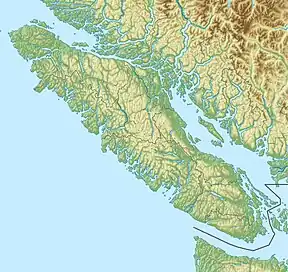
| Mount Tolmie | |
|---|---|
 Mount Tolmie  Mount Tolmie Mount Tolmie (British Columbia) | |
| Highest point | |
| Elevation | 120 m (390 ft) |
| Prominence | 120 m (390 ft) |
| Coordinates | 48°27′24.44″N 123°19′32″W / 48.4567889°N 123.32556°W[1] |
| Geography | |
| Location | British Columbia, Canada |
| District | Victoria Land District |
| Topo map | NTS 92B6 Victoria[1] |
Mount Tolmie, elevation 120 m (394 ft),[2] is a hill and surrounding neighbourhood in Saanich, Greater Victoria, British Columbia. The majority of the mountain forms Mount Tolmie Park, a municipal park, while the south side has several private residences. The peak of the hill is known for its excellent views of Victoria, the Olympic Mountains, and the San Juan Islands.[2]
Name
The hill is named for William Fraser Tolmie, a Scottish surgeon, fur trader, scientist, and politician employed by the Hudson's Bay Company. In 1859 Tolmie was transferred to Fort Victoria. He was later elected to the Legislative Assembly of Vancouver Island, the elected body of the Colony of Vancouver Island.
Geology
Although there are volcanic peaks in the Pacific Northwest such as Mount Baker and Mount Rainier, Mount Tolmie is composed of sedimentary rocks formed in the Cretaceous period about 100 million years ago, as is its nearby larger sibling Mount Douglas.
The neighbourhood
The namesake neighbourhood around the base of Mt. Tolmie is primarily residential, roughly bounded by McKenzie Avenue, Cedar Hill Road, McRae Avenue, Camosun College Lansdowne Campus, and the Henderson neighbourhood of Oak Bay Municipality.
References
- 1 2 "Mount Tolmie". Geographical Names Data Base. Natural Resources Canada. Retrieved 2021-05-25.
- 1 2 "Mount Tolmie Park". saanich.ca. Retrieved 2021-05-25.