Na Pho
นาโพธิ์ | |
|---|---|
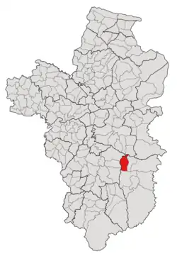 Subdistrict location in Ubon Ratchathani province | |
| Country | Thailand |
| Province | Ubon Ratchathani |
| District | Buntharik |
| Number of Muban | 11 |
| Number of Mu | 11 |
| Subdistrict established | 1973 |
| Area | |
| • Total | 78.40 km2 (30.27 sq mi) |
| Population (2021) | |
| • Total | 8,817 |
| • Density | 112.46/km2 (291.3/sq mi) |
| Time zone | UTC+7 (ICT) |
| Postal code | 34230 |
Na Pho (Thai: นาโพธิ์) is a tambon (subdistrict) located in the northwestern region of Buntharik district, in Ubon Ratchathani Province, Thailand.[1][2][3] In 2021, it had a population of 8,817 people.[1] Neighbouring subdistricts are (clockwise from the south) Nong Sano, Bua Ngam, Kham Khrang, Kut Prathai, Ang Sila, Non Kalong, and Ban Maet.[4]
History
The area was originally covered by deciduous dipterocarp forest and controlled by Kho Laen. Around the early 1800s, seven families from "Ban Khua Mi" (บ้านขัวหมี), which is now Nong Bua village (บ้านหนังบัว) in the Kho Laen subdistrict, relocated to the area and decided to construct a new hamlet called "Ban Huay Rai" (บ้านห้วยไร่), followed by another group of evacuees from the Phibun Mangsahan district. However, due to the outbreak, a new hamlet was temporarily abandoned, and the original residents eventually returned after being compelled to resettle in a nearby new location.[2]
The hamlet later gained official village status and was renamed "Na Pho", with Butsri Lue-det (บุตรศรี ลือเดช) as the first village headman,[2] and eventually became the new subdistrict capital when the same-named tambon (subdistrict) was created in 1973 by the splitting of eight villages in the Kho Laen subdistrict's half-western region.[3] Later in 1987, seven villages in the eastern area of tambon Na Pho were cut off to form a new subdistrict, Ban Maet.[5][6]
After its establishment, the tambon was governed by the Subdistrict Council of Na Pho until it was promoted to the Subdistrict Administrative Organization (SAO) in 1997, and to the subdistrict municipality in 2012.[7]
Geography
The tambon covers 78.4 km2 and is located in the northwestern region of the Buntharik district, on the Lam Dom Noi river basins in the east and north, with lowlands alternating with some highland in the west and south.[4]
Administration
The subdistrict of Na Pho is divided into 11 villages (mubans; หมู่บ้าน).[1][4] As of the 2021 census, it had a population of 8,817 people with 2,834 households.[1]
Since 2012, the Na Pho Subdistrict Municipality (เทศบาลตำบลนาโพธิ์) has been the local government responding to administer the area.[1][2][4]
The following is a list of the subdistrict's mubans, which roughly correspond to the villages.[1]
| Village | Group (Mu) | Household | Population | |
|---|---|---|---|---|
| Romanized name | Thai name | |||
| Na Pho | นาโพธิ์ | 1 | 252 | 776 |
| Khai | ค่าย | 2 | 258 | 774 |
| No Khueang | โนนเขือง | 3 | 248 | 816 |
| Don Tano | ดอนตะโน | 4 | 280 | 896 |
| Klang | กลาง | 5 | 319 | 827 |
| Na Pho Tai | นาโพธิ์ใต้ | 6 | 229 | 665 |
| Khum Kham | ขุมคำ | 7 | 212 | 776 |
| Na Pho Klang | นาโพธิ์กลาง | 8 | 305 | 759 |
| Sum Ngua | ซำงัว | 9 | 217 | 737 |
| Non Charoen | โนนเจริญ | 10 | 302 | 1,004 |
| Don Charoen | ดอนเจริญ | 11 | 212 | 687 |
| Central House Registration | 0 | 0 | ||
| Total | 2,824 | 8,817 | ||
References
- 1 2 3 4 5 6 "โครงสร้างข้อมูลสถิติจำนวนประชากร" (in Thai). Department of Provincial Administration of Thailand. 2021. Retrieved 15 December 2022. Alt URL
- 1 2 3 4 "ประวัติบ้านนาโพธิ์". www.npbb.go.th (in Thai). Na Pho Subdistrict Municipality. Archived from the original on 7 July 2022. Retrieved 18 December 2022.
- 1 2 "ประกาศกระทรวงมหาดไทย เรื่อง ตั้งและเปลี่นแปลงเขตตำบลในท้องที่อำเภออำนาจเจริญ อำเภอบุณฑริก และอำเภอพนา จังหวัดอุบลราชธานี" (PDF). www.ratchakitcha.soc.go.th (in Thai). Royal Thai Government Gazette. 4 September 1973. Archived from the original (PDF) on 5 June 2022. Retrieved 17 December 2022.
- 1 2 3 4 "ข้อมูลพื้นฐานทั่วไป-สภาพทั่วไป". www.npbb.go.th (in Thai). Na Pho Subdistrict Municipality. 2 December 2021. Archived from the original on 7 July 2022. Retrieved 18 December 2022.
- ↑ "ประกาศกระทรวงมหาดไทย เรื่อง ตั้งและเปลี่ยนแปลงเขตตำบลในท้องที่อำเภอตระการพืชผลบุณฑริก ศรีเมืองใหม่และอำเภออำนาจเจริญ จังหวัดอุบลราชธานี" (PDF). www.ratchakitcha.soc.go.th (in Thai). Royal Thai Government Gazette. 31 July 1987. Archived from the original (PDF) on 5 June 2022. Retrieved 17 December 2022.
- ↑ "ประวัติความเป็นมา". www.banmaed.go.th (in Thai). Subdistrict Administrative Organization of Ban Maet. Archived from the original on 14 August 2022. Retrieved 17 December 2022.
- ↑ "ประกาศคณะกรรมการการเลือกตั้ง เรื่อง การแบ่งเขตเลือกตั้งสมาชิกสภาเทศบาลในจังหวัดอุบลราชธานี [จำนวน ๓ แห่ง ๑. เทศบาลตำบลท่าช้าง อำเภอสว่างวีระวงศ์ ๒. เทศบาลตำบลเหล่าเสือโก้ก อำเภอเหล่าเสือโก้ก ๓. เทศบาลตำบลนาโพธิ์ อำเภอบุณฑริก" (PDF). www.ratchakitcha.soc.go.th (in Thai). Royal Thai Government Gazette. 28 November 2012. Archived from the original (PDF) on 17 December 2022. Retrieved 17 December 2022.